Prince Edward Island Route 7
 Route 7 | ||||
|---|---|---|---|---|
| Rustico Road | ||||
 | ||||
| Route information | ||||
| Maintained by Prince Edward Island Transportation and Public Works | ||||
| Length | 9.9 km[1] (6.2 mi) | |||
| Major junctions | ||||
| South end | ||||
| North end | ||||
| Location | ||||
| Country | Canada | |||
| Province | Prince Edward Island | |||
| Counties | Queens | |||
| Highway system | ||||
|
| ||||
| ||||
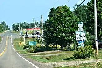
Prince Edward Island Route 7 is a secondary highway in central Prince Edward Island. The short connecting route begins at an intersection with Route 2 west of Charlottetown, and runs north to Oyster Bed Bridge, where the road continues as Route 6. It is an uncontrolled, paved two-lane road for its entire length.[2]
Major intersections
The entire route is in Queens County.
| Location | km[1] | mi | Destinations | Notes | |
|---|---|---|---|---|---|
| Milton Station | 0.0 | 0.0 | Southern terminus | ||
| North Milton | 2.0 | 1.2 | |||
| 2.5 | 1.6 | ||||
| Oyster Bed Bridge | 9.9 | 6.2 | Roundabout; northern terminus | ||
| 1.000 mi = 1.609 km; 1.000 km = 0.621 mi | |||||
References
- ^ a b "PEI Route 7" (Map). Google Maps. Retrieved September 18, 2019.
- ^ Prince Edward Island Provincial Road Atlas (PDF) (Map) (2014 ed.). Government of Prince Edward Island. pp. 26–27. Retrieved September 18, 2019.