Puerto Rico Highway 108
  Highway 108 | ||||
|---|---|---|---|---|
| Ruta 108 | ||||
| Route information | ||||
| Maintained by Puerto Rico DTPW | ||||
| Length | 22.0 km[1] (13.7 mi) | |||
| Major junctions | ||||
| South end | Calle Méndez Vigo in Mayagüez barrio-pueblo | |||
| ||||
| North end | ||||
| Location | ||||
| Country | United States | |||
| Territory | Puerto Rico | |||
| Municipalities | Mayagüez, Las Marías, Añasco | |||
| Highway system | ||||
| ||||
| ||||
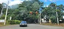
Puerto Rico Highway 108 (PR-108) is a road that travels from Mayagüez, Puerto Rico to Añasco.[2] It begins at its intersection with PR-105 (Calle de la Candelaria) in downtown Mayagüez and ends at its junction with PR-109 in eastern Añasco, near Las Marías and San Sebastián.[3] Near this road is located the Mayagüez Zoo.
Major intersections
| Municipality | Location | km[1] | mi | Destinations | Notes |
|---|---|---|---|---|---|
| Mayagüez | Mayagüez barrio-pueblo | 0.0 | 0.0 | PR-Calle Méndez Vigo – Mayagüez | Southern terminus of PR-108 |
| Miradero–Mayagüez barrio-pueblo line | 0.6 | 0.37 | |||
| Miradero | 2.8 | 1.7 | |||
| Miradero–Río Cañas Abajo line | 4.1 | 2.5 | |||
| 4.5 | 2.8 | ||||
| Mayagüez–Añasco municipal line | Leguísamo–Ovejas– Río Cañas tripoint | 8.8– 8.9 | 5.5– 5.5 | ||
| Leguísamo–Casey Arriba– Ovejas tripoint | 10.9 | 6.8 | |||
| Mayagüez | Leguísamo | 12.3– 12.4 | 7.6– 7.7 | ||
| 12.4– 12.5 | 7.7– 7.8 | ||||
| Las Marías | Anones | 15.9 | 9.9 | ||
| 18.9 | 11.7 | ||||
| Añasco | Corcovada | 22.0 | 13.7 | Northern terminus of PR-108 | |
| 1.000 mi = 1.609 km; 1.000 km = 0.621 mi | |||||
Related route
Highway 3108 | |
|---|---|
| Location | Mayagüez |
| Length | 1.5 km[4] (0.93 mi) |
Puerto Rico Highway 3108 (PR-3108) is a bypass road that branches off from PR-108 and ends at PR-2 north of the University of Puerto Rico at Mayagüez. This highway was officially designated as Paseo Juan Mari Brás.[5] The entire route is located in Mayagüez.

| Location | km[4] | mi | Destinations | Notes | |
|---|---|---|---|---|---|
| Miradero–Mayagüez barrio-pueblo line | 0.0 | 0.0 | Western terminus of PR-3108 | ||
| Miradero | 0.1– 0.2 | 0.062– 0.12 | |||
| 1.5 | 0.93 | Eastern terminus of PR-3108 | |||
| 1.000 mi = 1.609 km; 1.000 km = 0.621 mi | |||||
See also
References
- ^ a b "PR-108" (Map). Google Maps. Retrieved 5 March 2020.
- ^ National Geographic Maps (2011). Puerto Rico (Map). 1:125,000. Adventure Map (Book 3107). Evergreen, Colorado: National Geographic Maps. ISBN 978-1566955188. OCLC 756511572.
- ^ "Tránsito Promedio Diario (AADT)". Transit Data (Datos de Transito) (in Spanish). DTOP PR. pp. 58–59. Archived from the original on 1 April 2019.
- ^ a b "PR-3108" (Map). Google Maps. Retrieved 1 March 2020.
- ^ "Ley Núm. 89 del año 2013 Para denominar la nueva Carretera PR-3108 de la Ciudad de Mayagüez con el nombre del ilustre puertorriqueño Juan Mari Brás". LexJuris (Leyes y Jurisprudencia) de Puerto Rico (in Spanish). Retrieved 31 May 2019.
External links
Wikimedia Commons has media related to Puerto Rico Highway 108 and Puerto Rico Highway 3108.