Puerto Rico Highway 157
 Highway 157 | ||||
|---|---|---|---|---|
| Ruta 157 | ||||
| Route information | ||||
| Maintained by Puerto Rico DTPW | ||||
| Length | 24.3 km[1] (15.1 mi) | |||
| Existed | 1953[2]–present | |||
| Major junctions | ||||
| West end | ||||
| ||||
| East end | ||||
| Location | ||||
| Country | United States | |||
| Territory | Puerto Rico | |||
| Municipalities | Ciales, Orocovis | |||
| Highway system | ||||
| ||||
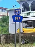
Puerto Rico Highway 157 (PR-157) is a rural road in Puerto Rico that travels from Ciales to Orocovis.[3] It begins at its intersection with PR-149 in Toro Negro and ends at its junction with PR-155 near downtown Orocovis.[4]
- Puerto Rico Highway 157
-
.jpg) Heading west between Collores and Damián Abajo barrios, Orocovis
Heading west between Collores and Damián Abajo barrios, Orocovis -
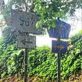
.jpg) Eastbound sign in Barros, Orocovis
Eastbound sign in Barros, Orocovis
Major intersections
-
 PR-6615 south near PR-157 junction between Collores and Damián Abajo barrios, Orocovis
 -
-
| Municipality | Location | km[1] | mi | Destinations | Notes |
|---|---|---|---|---|---|
| Ciales | Toro Negro | 0.0 | 0.0 | Western terminus of PR-157 | |
| Orocovis | Cacaos | 7.6 | 4.7 | ||
| Damián Abajo–Collores line | 10.6 | 6.6 | |||
| Barros–Damián Arriba line | 21.6 | 13.4 | |||
| Barros | 21.8 | 13.5 | |||
| Orocovis | 24.3 | 15.1 | Eastern terminus of PR-157 | ||
| 1.000 mi = 1.609 km; 1.000 km = 0.621 mi | |||||
See also
References
- ^ a b "PR-157" (Map). Google Maps. Retrieved 2 March 2020.
- ^ "Orocovis, Memoria Núm. 47" (PDF). Puerto Rico Planning Board (in Spanish). 1955. Retrieved 4 August 2020.
- ^ National Geographic Maps (2011). Puerto Rico (Map). 1:125,000. Adventure Map (Book 3107). Evergreen, Colorado: National Geographic Maps. ISBN 978-1566955188. OCLC 756511572.
- ^ "Tránsito Promedio Diario (AADT)". Transit Data (Datos de Transito) (in Spanish). DTOP PR. p. 85. Archived from the original on 1 April 2019.
External links
 Media related to Puerto Rico Highway 157 at Wikimedia Commons