Puerto Rico Highway 19
 Highway 19 | ||||
|---|---|---|---|---|
| Ruta 19 | ||||
| Avenida Luis Vigoreaux[1] | ||||
| Route information | ||||
| Maintained by Puerto Rico DTPW | ||||
| Length | 2.0 km[2] (1.2 mi) | |||
| Major junctions | ||||
| South end | ||||
| North end | ||||
| Location | ||||
| Country | United States | |||
| Territory | Puerto Rico | |||
| Municipalities | San Juan, Guaynabo | |||
| Highway system | ||||
| ||||
Puerto Rico Highway 19 (PR-19) is a short highway in Guaynabo.[3] It is the main avenue in San Patricio, Guaynabo. It begins at PR-20 and PR-21 in San Juan and ends an interchange with PR-2 and PR-20 in Guaynabo.[4]
Route description
PR-19 starts at its southern end at an interchange with PR-20 in San Juan. From this terminus, the highway runs through the interchange with PR-20 before intersecting PR-21 and turning northward parallel to the PR-20 freeway on its eastern side. After a short distance, the highway crosses the freeway on Avenida Luis Vigoreaux and then runs northwesterly to cross into Guaynabo. Running due north in Guaynabo, PR-19 passes through two roundabouts and ends at the interchange where PR-20 ends at PR-2.
-
 Puerto Rico Highway 19 north in San Juan
 -
 PR-19 south between Guaynabo and San Juan
 -
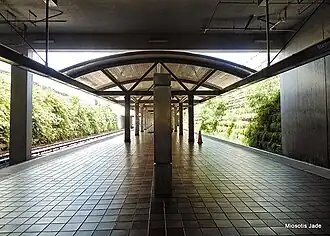 The Martínez Nadal train station in Guaynabo is off PR-19
Major intersections
-
.jpg) Signs for PR-19, PR-20 and PR-21 in Gobernador Piñero, San Juan
Signs for PR-19, PR-20 and PR-21 in Gobernador Piñero, San Juan -
.jpg) PR-19 north near PR-17 intersection in Gobernador Piñero, San Juan
PR-19 north near PR-17 intersection in Gobernador Piñero, San Juan -
.jpg) PR-19 north at the western terminus of PR-17 in Gobernador Piñero, San Juan
PR-19 north at the western terminus of PR-17 in Gobernador Piñero, San Juan
| Municipality | Location | km[2] | mi | Destinations | Notes |
|---|---|---|---|---|---|
| San Juan | Gobernador Piñero | 2.0 | 1.2 | Southern terminus of PR-19; no entrance ramp to PR-20 northbound | |
| 1.6 | 0.99 | ||||
| Guaynabo | Pueblo Viejo | 0.0 | 0.0 | Northern terminus of PR-19; PR-2 eastbound exit and PR-20 southbound entrance | |
| 1.000 mi = 1.609 km; 1.000 km = 0.621 mi | |||||
See also
References
- ^ "pr.geoview.info". Retrieved 1 June 2019.
- ^ a b "PR-19" (Map). Google Maps. Retrieved 28 February 2020.
- ^ National Geographic Maps (2011). Puerto Rico (Map). 1:125,000. Adventure Map (Book 3107). Evergreen, Colorado: National Geographic Maps. ISBN 978-1566955188. OCLC 756511572.
- ^ Puerto Rico Department of Transportation and Public Works. "Datos de Transito 2000-2009" (in Spanish). Archived from the original on 1 April 2019. Retrieved 28 February 2020.
External links
 Media related to Puerto Rico Highway 19 at Wikimedia Commons