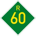
R60 (South Africa)
 | ||||
|---|---|---|---|---|
.svg.png) | ||||
| Route information | ||||
| Maintained by WCDTPW | ||||
| Length | 112 km (70 mi) | |||
| Major junctions | ||||
| Northwest end | ||||
| Southeast end | ||||
| Location | ||||
| Country | South Africa | |||
| Major cities | Worcester, Robertson, Ashton, Swellendam | |||
| Highway system | ||||
| ||||
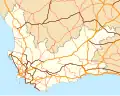
The R60 is a provincial route in Western Cape, South Africa that runs along the Breede River Valley, connecting Worcester with Swellendam via Robertson.[1] It also provides a high-speed highway link between the N1 and the N2 national roads.
References
- ^ Falkner, John (May 2012). South African Numbered Route Description and Destination Analysis (Report). National Department of Transport. p. 60. Archived from the original on 6 June 2014. Retrieved 13 August 2014.