Raccoon Township, Parke County, Indiana
Raccoon Township | |
|---|---|
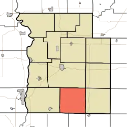 Location in Parke County | |
| Coordinates: 39°39′01″N 87°10′55″W / 39.65028°N 87.18194°W | |
| Country | |
| State | |
| County | Parke |
| Government | |
| • Type | Indiana township |
| Area | |
• Total | 37.09 sq mi (96.1 km2) |
| • Land | 37.05 sq mi (96.0 km2) |
| • Water | 0.04 sq mi (0.1 km2) 0.11% |
| Elevation | 551 ft (168 m) |
| Population (2020) | |
• Total | 689 |
| • Density | 19/sq mi (7.2/km2) |
| Time zone | UTC-5 (Eastern (EST)) |
| • Summer (DST) | UTC-4 (EDT) |
| ZIP codes | 47836, 47837, 47872, 47874 |
| Area code | 765 |
| GNIS feature ID | 453778 |
Raccoon Township is one of thirteen townships in Parke County, Indiana, United States. At the 2020 census, its population was 689 and it had 341 housing units.[2]
| Census | Pop. | Note | %± |
|---|---|---|---|
| 1890 | 1,702 | — | |
| 1900 | 2,680 | 57.5% | |
| 1910 | 2,821 | 5.3% | |
| 1920 | 1,674 | −40.7% | |
| 1930 | 1,289 | −23.0% | |
| 1940 | 1,353 | 5.0% | |
| 1950 | 1,006 | −25.6% | |
| 1960 | 921 | −8.4% | |
| 1970 | 711 | −22.8% | |
| 1980 | 856 | 20.4% | |
| 1990 | 818 | −4.4% | |
| 2000 | 771 | −5.7% | |
| 2010 | 659 | −14.5% | |
| 2020 | 689 | 4.6% | |
| Source: US Decennial Census[3] | |||
History
Raccoon Township took its name from the Big and Little Raccoon creeks.[4]
The Bridgeton Covered Bridge, Bridgeton Historic District, Conley's Ford Covered Bridge, Jeffries Ford Covered Bridge and Nevins Covered Bridge are listed on the National Register of Historic Places.[5]
Geography
According to the 2010 census, the township has a total area of 37.09 square miles (96.1 km2), of which 37.05 square miles (96.0 km2) (or 99.89%) is land and 0.04 square miles (0.10 km2) (or 0.11%) is water.[6]
Unincorporated towns
- Bridgeton at 39°38′42″N 87°10′39″W / 39.645041°N 87.177515°W
- Catlin at 39°41′37″N 87°14′07″W / 39.693651°N 87.235293°W
- Diamond at 39°36′41″N 87°09′58″W / 39.61143°N 87.166126°W
- Minshall at 39°40′18″N 87°13′18″W / 39.671707°N 87.221682°W
- Smockville at 39°37′34″N 87°07′59″W / 39.626153°N 87.13307°W
- Snow Hill at 39°39′20″N 87°10′12″W / 39.655597°N 87.170015°W
- Superior at 39°37′46″N 87°09′20″W / 39.629485°N 87.155570°W
(This list is based on USGS data and may include former settlements.)
Extinct towns
(These towns are listed as "historical" by the USGS.)
Cemeteries
The township contains five cemeteries: Brunot, Clear Run, Denman, Hartmans and Webster.
School districts
- Southwest Parke Community School Corporation
Political districts
- State House District 42
- State Senate District 38
References
- ^ "US Board on Geographic Names". United States Geological Survey. October 25, 2007. Retrieved May 9, 2017.
- ^ "Explore Census Data". data.census.gov. Retrieved April 13, 2024.
- ^ "Township Census Counts: STATS Indiana".
- ^ History of Parke and Vermillion Counties, Indiana. B.F. Bowen & Cos. 1913. p. 208.
- ^ "National Register Information System". National Register of Historic Places. National Park Service. July 9, 2010.
- ^ "Population, Housing Units, Area, and Density: 2010 - County – County Subdivision and Place – 2010 Census Summary File 1". United States Census. Retrieved May 10, 2013.
- "Raccoon Township, Parke County, Indiana". Geographic Names Information System. United States Geological Survey, United States Department of the Interior. Retrieved November 1, 2009.
- United States Census Bureau 2009 TIGER/Line Shapefiles
- IndianaMap
External links
- Indiana Township Association
- United Township Association of Indiana
- City-Data.com page for Raccoon Township
Places adjacent to Raccoon Township, Parke County, Indiana | |
|---|---|
Municipalities and communities of Parke County, Indiana, United States | ||
|---|---|---|
| Towns |  | |
| Townships | ||
| CDPs | ||
| Other communities |
| |
| Ghost town | ||
| Footnotes | ‡This populated place also has portions in an adjacent county or counties | |