Raposa
Raposa | |
|---|---|
Municipality | |
| The Municipality of Raposa | |
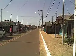 A street in Raposa | |
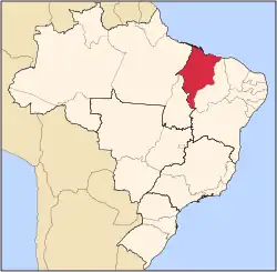
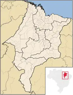 Location of Raposa in the State of Maranhão | |
| Coordinates: 02°26′14″S 44°06′08″W / 2.43722°S 44.10222°W | |
| Country | Brazil |
| Region | Northeast |
| State | Maranhão |
| Founded | November 10, 1994 |
| Government | |
| • Mayor | Onacy Vieira Carneiro (PP) |
| Area | |
• Total | 64.182 km2 (24.781 sq mi) |
| [1] | |
| Population (2020 [2]) | |
• Total | 31,177 |
| • Density | 490/km2 (1,300/sq mi) |
| Time zone | UTC−3 (BRT) |
| HDI (2000) | 0.632 – medium[3] |
| Website | www.raposa.ma.gov.br |
Raposa is a municipality in the state of Maranhão in the Northeast region of Brazil.[4][5] It is the smallest municipality of Maranhão.
The municipality contains part of the 1,535,310 hectares (3,793,800 acres) Upaon-Açu/Miritiba/Alto Preguiças Environmental Protection Area, created in 1992.[6]
See also
References
- ^ IBGE - [1]
- ^ IBGE 2020
- ^ [2] UNDP
- ^ "Divisão Territorial do Brasil" (in Portuguese). Divisão Territorial do Brasil e Limites Territoriais, Instituto Brasileiro de Geografia e Estatística (IBGE). July 1, 2008. Retrieved December 17, 2009.
- ^ "Produto Interno Bruto dos Municípios 2002-2005" (PDF) (in Portuguese). Instituto Brasileiro de Geografia e Estatística (IBGE). December 19, 2007. Retrieved December 17, 2009.
- ^ APA Upaon-Açu/Miritiba/Alto Preguiças (in Portuguese), ISA: Instituto Socioambiental, retrieved 2017-02-09
{{citation}}: CS1 maint: publisher location (link)