Red Lion Hill
| Red Lion Hill | |
|---|---|
| Banc y Dolau | |
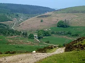 A view of Red Lion Hill | |
| Highest point | |
| Elevation | 484.6 m (1,590 ft) |
| Coordinates | 52°22′47″N 3°23′19″W / 52.37970°N 3.38853°W |
| Naming | |
| Native name | Bryn Llew Goch (Welsh) |
| Geography | |
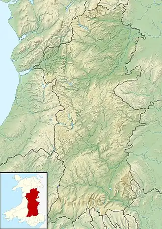 Red Lion Hill Red Lion Hill shown within Powys | |
| OS grid | SO 0558 7664 |
| Topo map | OS Explorer 214 |
Red Lion Hill (Welsh: Bryn Llew Goch) or Banc y Dolau is a hill in Powys, Wales, with a summit 484.6 metres (1,590 ft) above sea level.[1] It is located in Mid Wales between the towns of Newtown and Llandrindod Wells, approximately three point two kilometres (2 mi) to the west of the A483 road.[2]
At the beginning of the twentieth century the area immediately to the east of the hill was known as Red Lion Plantations, and just beyond that was a small hamlet called Red Lion.[3] As of 2020 Red Lion consists of just a single dwelling,[4] which Royal Mail considers to be part of nearby Llanbadarn Fynydd.[5]
A building labelled Red Lion School is shown on the 1st edition Ordnance Survey Map at SO0681576817.
References
- ^ "RED LION HILL, POWYS - POWYS". GetOutside. Ordnance Survey. Retrieved 10 March 2020.
- ^ "52°22'46.9"N 3°23'18.7"W" (Map). Google Maps. Retrieved 10 March 2020.
- ^ "Explore georeferenced maps". National Library of Scotland. 1904. Retrieved 10 March 2020.
- ^ "OS Maps". Ordnance Survey. Retrieved 10 March 2020.
- ^ "Postcode Finder – Find an Address (LD1 6YW)". Royal Mail. Retrieved 10 March 2020.