Rivière-Saint-Jean, Gaspésie–Îles-de-la-Madeleine, Quebec
Rivière-Saint-Jean | |
|---|---|
.jpg) Anse de l'Étang | |
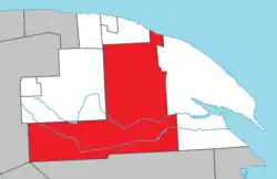 Location within La Côte-de-Gaspé RCM | |
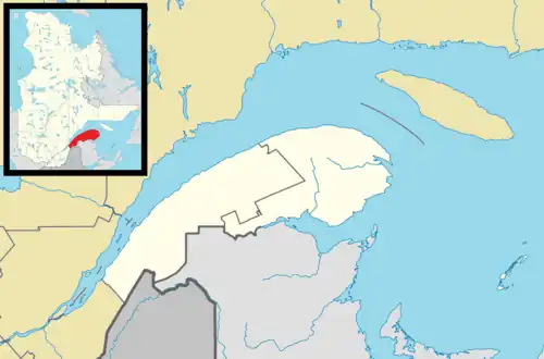 Rivière-Saint-Jean Location in eastern Quebec | |
| Coordinates: 48°50′N 64°55′W / 48.833°N 64.917°W[1] | |
| Country | Canada |
| Province | Quebec |
| Region | Gaspésie–Îles-de-la-Madeleine |
| RCM | La Côte-de-Gaspé |
| Constituted | January 1, 1986 |
| Government | |
| • Federal riding | Gaspésie—Les Îles-de-la-Madeleine—Listuguj |
| • Prov. riding | Gaspé |
| Area | |
• Total | 1,756.21 km2 (678.08 sq mi) |
| • Land | 1,748.14 km2 (674.96 sq mi) |
| Population (2021)[3] | |
• Total | 0 |
| • Density | 0.0/km2 (0/sq mi) |
| • Pop (2016-21) | |
| • Dwellings | 3 |
| Time zone | UTC-5 (EST) |
| • Summer (DST) | UTC-4 (EDT) |
| Highways | |
Rivière-Saint-Jean (French pronunciation: [ʁivjɛʁ sɛ̃ ʒɑ̃], "St. John River") is an unorganized territory in the Gaspésie–Îles-de-la-Madeleine region of Quebec, Canada. It is bisected by Quebec Route 198 that runs along the banks of the York River.
The territory is named after the Saint-Jean River that is considered one of the best salmon rivers in Quebec. This 90 kilometres (56 mi) long river has its source in the Chic-Choc Mountains, about 5 kilometres (3.1 mi) south of Murdochville, and runs in a south-east direction for the first 35 kilometres (22 mi), then east to the Bay of Gaspé. Portions of the river are protected in the Rivière-Saint-Jean Wildlife Reserve.[4]
The only locality in the territory is Grand-Étang,[5] located along Route 132 at the namesake Grand Étang (French for "Great Pond").[6]
Demographics
Population
| Year | Pop. | ±% |
|---|---|---|
| 1991 | 0 | — |
| 1996 | 0 | 0.00% |
| 2001 | 0 | 0.00% |
| 2006 | 0 | 0.00% |
| 2011 | 0 | 0.00% |
| 2026 | 0 | 0.00% |
| 2021 | 0 | 0.00% |
| Source: Statistics Canada[7] | ||
See also
References
- ^ "Banque de noms de lieux du Québec: Reference number 149671". toponymie.gouv.qc.ca (in French). Commission de toponymie du Québec.
- ^ a b "Répertoire des municipalités: Geographic code 03902". www.mamh.gouv.qc.ca (in French). Ministère des Affaires municipales et de l'Habitation. Retrieved 2024-08-18.
- ^ a b "Rivière-Saint-Jean, Gaspésie–Îles-de-la-Madeleine, Quebec (Code 2403902) Census Profile". 2021 census. Government of Canada - Statistics Canada. Retrieved 2024-08-18.
- ^ "Rivière Saint-Jean" (in French). Commission de toponymie du Québec. Retrieved 2011-12-05.
- ^ "Grand-Étang". Geographical Names Data Base. Natural Resources Canada. Retrieved 19 August 2024.
- ^ "Grand Étang". Geographical Names Data Base. Natural Resources Canada. Retrieved 19 August 2024.
- ^ 1996, 2001, 2006, 2011 census
External links
![]() Media related to Rivière-Saint-Jean, Gaspésie–Îles-de-la-Madeleine, Quebec at Wikimedia Commons
Media related to Rivière-Saint-Jean, Gaspésie–Îles-de-la-Madeleine, Quebec at Wikimedia Commons
Adjacent Municipal Subdivisions | |
|---|---|
| Cities | |
|---|---|
| Municipalities | |
| Townships | |
| Unorganized territories | |
| |