Sabaya
Sabaya | |
|---|---|
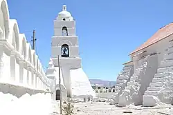 Church of Sabaya | |
| Coordinates: 19°00′53″S 68°22′15″W / 19.01472°S 68.37083°W | |
| Country | |
| Department | Oruro |
| Province | Sabaya Province |
| Municipality | Sabaya Municipality |
| Population (2001) | |
• Total | 573 |
| Time zone | UTC-4 (BOT) |
Sabaya is a small town in the Bolivian Oruro Department. In 2001 it had a population of 573 inhabitants in 2001.[1] Sabaya is the administrative center of both the Sabaya Province and the Sabaya Municipality. It is located 200 km (120 mi) south-west of Oruro, the department capital. It is situated at 3,698 m (12,133 ft) above sea level in the valley of the Sabaya River on the eastern slopes of Pumari (4,787 m [15,705 ft]). Salar de Coipasa lies 25 km (16 mi) south-east of Sabaya, and the stratovolcano Tata Sabaya (5,430 m [17,810 ft]) is situated 20 km (12 mi) south-west of Sabaya.
See also
References
Capital: Oruro | ||
| Provinces | 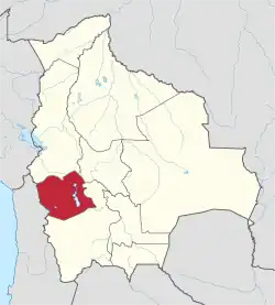 | |
| Municipalities (and seats) |
| |