Sahel Wadi Elma
Sahel Wadi Elma
Arabic: أم العمد أو سيل وادي الما | |
|---|---|
| Sahel Wadi Elma | |
| Country | |
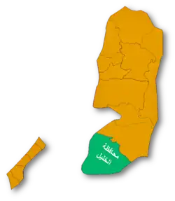
| Governorate | Hebron Governorate |
| Population (2017) | |
• Total | 397 |
Sahel Wadi Elma Umm al-Amad, also known as the Wadi al-Ma Plain, is a Palestinian village located in the southern West Bank, south of Hebron and east of Yatta.[1] [2]
Population
According to 2017 estimates from the Palestinian Central Bureau of Statistics, the population of Sahel Wadi Elma (Umm al-Amad) was 397.[3]
Local Governance
Umm al-Amad is administered by the Khalet al-Maiyya Municipal Council, which operates under the jurisdiction of the Palestinian Ministry of Local Government.[4]
See also
References
- ^ "دليل قرية واد الما_ أم العمد" (PDF). vprofile.arij.org.
- ^ "حرب حزيران / 1967". وكالة الأنباء والمعلومات الفلسطينية - وفا. Archived from the original on 2023-03-14. Retrieved 2025-06-09.
- ^ "عدد السكان المقدر في منتصف العام لمحافظة الخليل حسب التجمع 2017-2021". www.pcbs.gov.ps. Retrieved 2025-06-09.
- ^ "دليل الحدود االنتخابية للهيئات المحلية 2021" (PDF). www.elections.ps. Archived from the original (PDF) on 2023-12-15. Retrieved 2025-06-09.