Saint-Gilles, Quebec
Saint-Gilles | |
|---|---|
Municipality | |
.jpg) Aerial view of Saint-Gilles | |
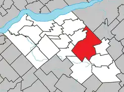 Location within Lotbinière RCM. | |
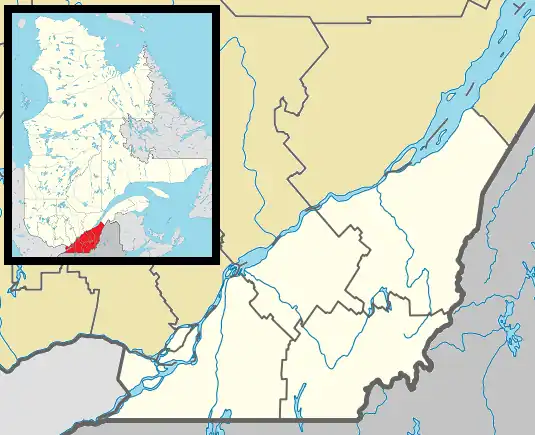 Saint-Gilles Location in southern Quebec. | |
| Coordinates: 46°31′N 71°22′W / 46.517°N 71.367°W[1] | |
| Country | Canada |
| Province | Quebec |
| Region | Chaudière-Appalaches |
| RCM | Lotbinière |
| Constituted | July 1, 1855 |
| Named after | Saint Giles[1] |
| Government | |
| • Mayor | Robert Samson |
| • Federal riding | Lotbinière— Chutes-de-la-Chaudière |
| • Prov. riding | Lotbinière-Frontenac |
| Area | |
• Total | 180.80 km2 (69.81 sq mi) |
| • Land | 177.43 km2 (68.51 sq mi) |
| Population | |
• Total | 2,910 |
| • Density | 16.4/km2 (42/sq mi) |
| • Pop 2016-2021 | |
| • Dwellings | 1,264 |
| Time zone | UTC−5 (EST) |
| • Summer (DST) | UTC−4 (EDT) |
| Postal code(s) | |
| Area codes | 418 and 581 |
| Highways | |
| Website | www |
Saint-Gilles (French pronunciation: [sɛ̃ ʒil] ⓘ) is a municipality in Lotbinière Regional County Municipality in the Chaudière-Appalaches region of Quebec, Canada. Its population was 2,910 as of the Canada 2021 Census.
The municipality has the largest surface area in Lotbinière Regional County Municipality, with a surface area of around 177.43 km2 and a population density of around 16.4 inhabitants/km2.
Saint-Gilles is named after the seigneurie of Saint-Gilles of which it was part. It was granted in 1738 to Gilles Rageot de Beaurivage (1689-1754), an important merchant from Quebec.[4]
References
- ^ a b "Banque de noms de lieux du Québec: Reference number 56670". toponymie.gouv.qc.ca (in French). Commission de toponymie du Québec.
- ^ a b "Répertoire des municipalités: Geographic code 33035". www.mamh.gouv.qc.ca (in French). Ministère des Affaires municipales et de l'Habitation.
- ^ a b "Data table, Census Profile, 2021 Census of Population - Saint-Gilles, Municipalité (MÉ) [Census subdivision], Quebec". 9 February 2022.
- ^ "Fiche descriptive".
Places adjacent to Saint-Gilles, Quebec | |
|---|---|
| Municipalities | |
|---|---|
| Parishes | |
| Villages | |
| |