Saint-Henri, Chaudière-Appalaches, Quebec
Saint-Henri | |
|---|---|
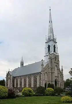 Saint-Henri Church | |
_Quebec_location_diagram.png) Location within Bellechasse RCM. | |
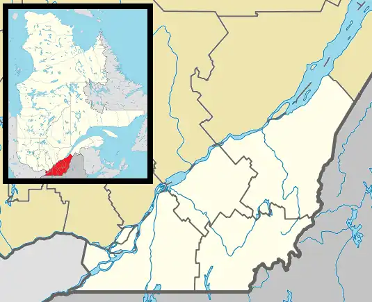 Saint-Henri Location in province of Quebec. | |
| Coordinates: 46°42′N 71°04′W / 46.700°N 71.067°W[1] | |
| Country | |
| Province | |
| Region | Chaudière-Appalaches |
| RCM | Bellechasse |
| Constituted | October 9, 1976 |
| Government | |
| • Mayor | Germain Caron |
| • Federal riding | Bellechasse—Les Etchemins—Lévis |
| • Prov. riding | Bellechasse |
| Area | |
• Total | 124.20 km2 (47.95 sq mi) |
| • Land | 122.57 km2 (47.32 sq mi) |
| Population (2016)[3] | |
• Total | 5,611 |
| • Density | 45.8/km2 (119/sq mi) |
| • Pop 2011-2016 | |
| • Dwellings | 2,365 |
| Time zone | UTC−5 (EST) |
| • Summer (DST) | UTC−4 (EDT) |
| Postal code(s) | |
| Area codes | 418 and 581 |
| Highways | |
| Website | www.municipalite. saint-henri.qc.ca |
Saint-Henri (French pronunciation: [sɛ̃ ɑ̃ʁi]) is a municipality of 5,611 people, 20 km south of Lévis, in the Bellechasse Regional County Municipality of Quebec, Canada. It is sometimes known as Saint-Henri-de-Lévis, and was historically known as Saint-Henri-de-Lauzon.
It used to belong to the former Desjardins Regional County Municipality, but decided to join Bellechasse in 2000 when the new city of Lévis was created. Saint-Henri felt it did not belong with a mostly urban RCM, and would fit better with Bellechasse, which has a largely rural base. Now, Saint-Henri is the biggest town in this RCM, followed by Saint-Anselme and Sainte-Claire. The Etchemin River crosses the municipality and one hydroelectric dam is found in Saint-Henri. On November 6, 1775, Benedict Arnold is said to have visited the village on his way to attack Quebec City. The largest local business is Olymel, a meat processing factory.
Demographics
Population
| 2016 | 2011 | |
|---|---|---|
| Population | 5,611 (+11.7% from 2011) | 5,023 (+22.7% from 2006) |
| Land area | 122.57 km2 (47.32 sq mi) | 122.29 km2 (47.22 sq mi) |
| Population density | 45.8/km2 (119/sq mi) | 41.1/km2 (106/sq mi) |
| Median age | 37.0 (M: 37.3, F: 36.7) | 36.4 (M: 36.5, F: 36.1) |
| Private dwellings | 2,365 (total) | 2,145 (total) |
| Median household income | $73,244 | $62,174 |
References
- ^ "Banque de noms de lieux du Québec: Reference number 72562". toponymie.gouv.qc.ca (in French). Commission de toponymie du Québec.
- ^ a b "Répertoire des municipalités: Geographic code 19068". www.mamh.gouv.qc.ca (in French). Ministère des Affaires municipales et de l'Habitation.
- ^ a b "Census Profile, 2016 Census - Saint-Henri, Municipalité [Census subdivision], Quebec and Saint-Raymond [Population centre], Quebec". 2.statcan.gc.ca. 8 February 2017. Retrieved 2022-04-24.
- ^ "2016 Community Profiles". 2016 Canadian census. Statistics Canada. August 12, 2021. Retrieved 2022-07-18.
- ^ "2011 Community Profiles". 2011 Canadian census. Statistics Canada. March 21, 2019. Retrieved 2022-07-18.
Places adjacent to Saint-Henri, Chaudière-Appalaches, Quebec | |
|---|---|
| Municipalities | |
|---|---|
| Parishes | |
| |