Saint-Wenceslas, Quebec
Saint-Wenceslas | |
|---|---|
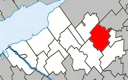 Location within Nicolet-Yamaska RCM. | |
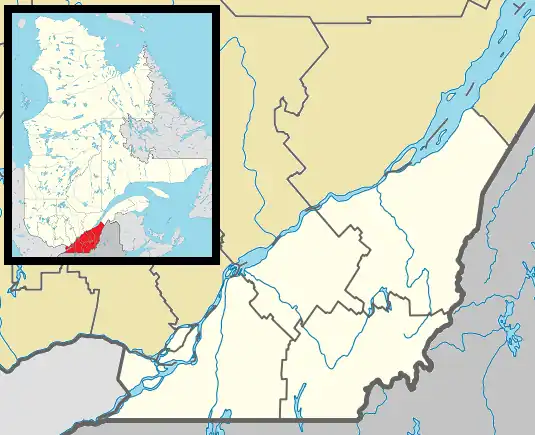 Saint-Wenceslas Location in southern Quebec. | |
| Coordinates: 46°10′N 72°20′W / 46.167°N 72.333°W[1] | |
| Country | |
| Province | |
| Region | Centre-du-Québec |
| RCM | Nicolet-Yamaska |
| Constituted | October 11, 1995 |
| Named after | Wenceslaus I, Duke of Bohemia[1] |
| Government | |
| • Mayor | vacant |
| • Federal riding | Bécancour—Nicolet—Saurel |
| • Prov. riding | Nicolet-Bécancour |
| Area | |
• Total | 79.70 km2 (30.77 sq mi) |
| • Land | 79.57 km2 (30.72 sq mi) |
| Population | |
• Total | 1,167 |
| • Density | 14.7/km2 (38/sq mi) |
| • Pop 2016-2021 | |
| • Dwellings | 551 |
| Time zone | UTC−5 (EST) |
| • Summer (DST) | UTC−4 (EDT) |
| Postal code(s) | |
| Area code | 819 |
| Highways | |
| Website | www.municipalite stwenceslas.com |
Saint-Wenceslas, Quebec is a municipality in Nicolet-Yamaska Regional County Municipality, Quebec, Canada. The town is situated at a bend in the Bécancour River. The northern branch of Autoroute 55 terminated at the 9e rang of Saint-Wenceslas until its completion in October 2006. Route 161 also goes through the town.
The village church in Saint-Wenceslas was designed by Jean-Baptiste Louis Bourgeois, a local architect who also designed a Bahá'í House of Worship in the town of Wilmette, United States.
Demographics
| Census | Population | Change (%) |
|---|---|---|
| 2021 | 1,167 | |
| 2016 | 1,157 | |
| 2011 | 1,064 | |
| 2006 | 1,101 | |
| 2001 | 1,132 | |
| 1996 | 1,170 | |
| 1991 | 810 | |
| 1986 | 859 | |
| 1981 | 847 | |
| 1976 | 776 | |
| 1971 | 798 | |
| 1966 | 836 | |
| 1961 | 896 | |
| 1956 | 933 | |
| 1951 | 957 | |
| 1941 | 1,007 | |
| 1931 | 1,035 | |
| 1921 | 1,515 | |
| 1911 | 1,725 | |
| 1901 | 1,626 | |
| 1891 | 1,909 | |
| 1881 | 1,297 | |
| 1871 | 729 | N/A |
See also
References
- ^ a b "Banque de noms de lieux du Québec: Reference number 308946". toponymie.gouv.qc.ca (in French). Commission de toponymie du Québec.
- ^ a b "Répertoire des municipalités: Geographic code 50023". www.mamh.gouv.qc.ca (in French). Ministère des Affaires municipales et de l'Habitation.
- ^ a b https://www12.statcan.gc.ca/census-recensement/2021/dp-pd/prof/details/page.cfm?LANG=E&GENDERlist=1&STATISTIClist=1,4&DGUIDlist=2021A00052450023&HEADERlist=0&SearchText=Saint-Wenceslas
- ^ Statistics Canada: 1996, 2001, 2006, 2011, 2016, 2021 census
Adjacent Municipal Subdivisions | |
|---|---|
| Cities | |
|---|---|
| Municipalities | |
| Parishes | |
| Villages | |
| |