Sainte-Radegonde, Deux-Sèvres
Sainte-Radegonde | |
|---|---|
Part of Thouars | |
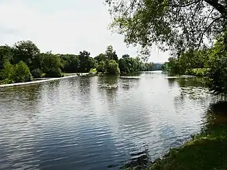 The river Thouet in Sainte-Radegonde | |
Location of Sainte-Radegonde | |
 Sainte-Radegonde  Sainte-Radegonde | |
| Coordinates: 46°59′07″N 0°14′45″W / 46.9853°N 0.2458°W | |
| Country | France |
| Region | Nouvelle-Aquitaine |
| Department | Deux-Sèvres |
| Arrondissement | Bressuire |
| Canton | Thouars |
| Commune | Thouars |
Area 1 | 7.52 km2 (2.90 sq mi) |
| Population (2022)[1] | 1,801 |
| • Density | 240/km2 (620/sq mi) |
| Time zone | UTC+01:00 (CET) |
| • Summer (DST) | UTC+02:00 (CEST) |
| Postal code | 79100 |
| Elevation | 43–111 m (141–364 ft) (avg. 60 m or 200 ft) |
| 1 French Land Register data, which excludes lakes, ponds, glaciers > 1 km2 (0.386 sq mi or 247 acres) and river estuaries. | |
Sainte-Radegonde (French pronunciation: [sɛ̃t ʁadɡɔ̃d]; sometimes spelled Sainte-Radégonde) is a former commune in the Deux-Sèvres department in western France. On 1 January 2019, it was merged into the commune Thouars.[2]
See also
References
- ^ "Populations de référence 2022" [Reference populations 2022] (PDF) (in French). INSEE. December 2024.
- ^ Arrêté préfectoral 30 October 2018 (in French)
Wikimedia Commons has media related to Sainte-Radegonde (Deux-Sèvres).