San Jacinto, Nevada
San Jacinto, Nevada | |
|---|---|
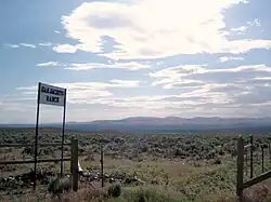 San Jacinto Ranch, 2009 | |
 San Jacinto Location of San Jacinto  San Jacinto San Jacinto (the United States) | |
| Coordinates: 41°52′07″N 114°40′35″W / 41.86861°N 114.67639°W[1] | |
| Country | United States |
| State | Nevada |
| County | Elko |
| Elevation | 5,200 ft (1,585 m) |
| Time zone | UTC-8 (Pacific (PST)) |
| • Summer (DST) | UTC-7 (PDT) |
| ZIP code | 89825 |
| Area code | 775 |
| GNIS feature ID | 845648[1] |
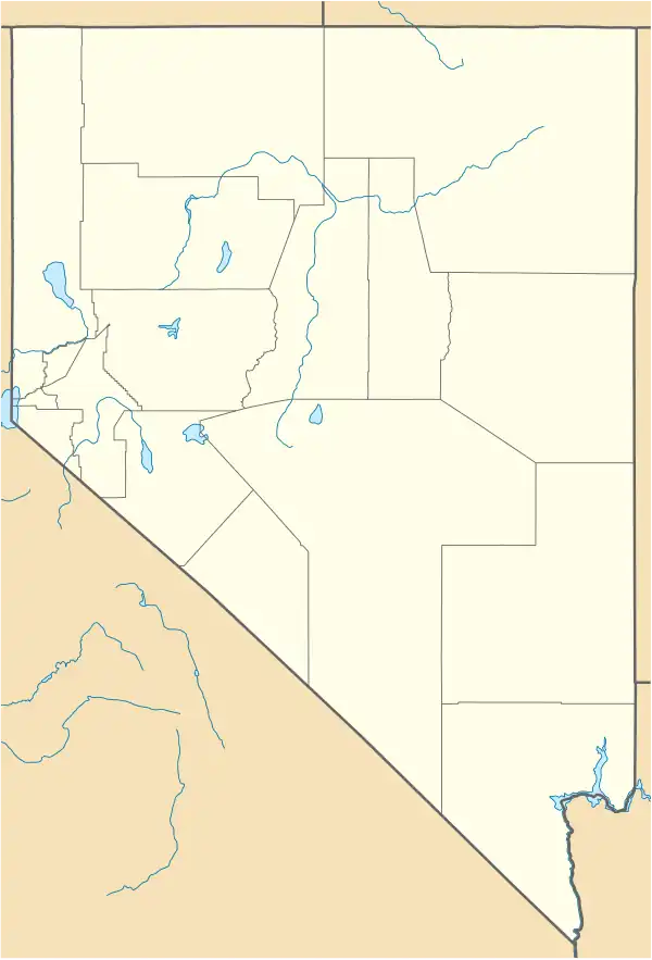
San Jacinto is a ghost town in along Salmon Falls Creek in northern Elko County, Nevada, United States.[1] It is part of the Elko Micropolitan Statistical Area.
History
It was the site of a railroad station located eight miles northeast of Contact, Nevada on the Union Pacific railroad.[2]
It is named after the San Jacinto Ranch,[3] which in turn is named for the Battle of San Jacinto, fought at present-day Houston, Texas in 1836.[2]
The San Jacinto post office was in operation from November 1898 through April 1938.[4]
The lowest temperature ever recorded in Nevada, −50 °F (−46 °C) was recorded in San Jacinto on January 8, 1937.[5]
The population was 25 in 1940.[6]
The site of the former community is east of U.S. Route 93.
Climate
| Climate data for San Jacinto, Nevada | |||||||||||||
|---|---|---|---|---|---|---|---|---|---|---|---|---|---|
| Month | Jan | Feb | Mar | Apr | May | Jun | Jul | Aug | Sep | Oct | Nov | Dec | Year |
| Record high °F (°C) | 65 (18) |
68 (20) |
74 (23) |
85 (29) |
92 (33) |
100 (38) |
104 (40) |
108 (42) |
95 (35) |
90 (32) |
78 (26) |
68 (20) |
108 (42) |
| Mean daily maximum °F (°C) | 36.5 (2.5) |
41.3 (5.2) |
49.7 (9.8) |
58.6 (14.8) |
66.6 (19.2) |
76.2 (24.6) |
87.4 (30.8) |
84.9 (29.4) |
76.0 (24.4) |
62.8 (17.1) |
49.5 (9.7) |
40.2 (4.6) |
60.8 (16.0) |
| Mean daily minimum °F (°C) | 11.4 (−11.4) |
16.8 (−8.4) |
22.7 (−5.2) |
28.7 (−1.8) |
34.4 (1.3) |
39.8 (4.3) |
45.4 (7.4) |
41.3 (5.2) |
33.3 (0.7) |
25.9 (−3.4) |
18.3 (−7.6) |
13.6 (−10.2) |
27.6 (−2.4) |
| Record low °F (°C) | −50 (−46) |
−34 (−37) |
−16 (−27) |
−3 (−19) |
11 (−12) |
19 (−7) |
30 (−1) |
21 (−6) |
10 (−12) |
0 (−18) |
−22 (−30) |
−45 (−43) |
−50 (−46) |
| Average precipitation inches (mm) | 0.66 (17) |
0.47 (12) |
0.59 (15) |
0.93 (24) |
1.29 (33) |
1.16 (29) |
0.51 (13) |
0.48 (12) |
0.47 (12) |
0.60 (15) |
0.62 (16) |
0.56 (14) |
8.34 (212) |
| Average snowfall inches (cm) | 7.1 (18) |
4.5 (11) |
3.7 (9.4) |
2.8 (7.1) |
1.3 (3.3) |
0.2 (0.51) |
0.0 (0.0) |
0.0 (0.0) |
0.3 (0.76) |
0.7 (1.8) |
3.1 (7.9) |
5.3 (13) |
28.9 (73) |
| Source: WRCC[7] | |||||||||||||
References
- ^ a b c d "San Jacinto". Geographic Names Information System. United States Geological Survey, United States Department of the Interior.
- ^ a b Carlson, Helen S. (1985). Nevada Place Names: A Geographical Dictionary. University of Nevada Press. ISBN 978-0-87417-094-8. Retrieved June 7, 2020.
- ^ "San Jacinto Ranch". Geographic Names Information System. United States Geological Survey, United States Department of the Interior.
- ^ U.S. Geological Survey Geographic Names Information System: San Jacinto Post Office (historical)
- ^ National Climatic Data Center. "State Climate Extremes Committee (SCEC)". Retrieved March 22, 2015.
- ^ The Attorneys List. Baltimore, MD: United States Fidelity and Guaranty Co. p. 600.
- ^ "SAN JACINTO, NEVADA (267284)". Desert Research Institute. Retrieved June 12, 2016.
External links
![]() Media related to San Jacinto, Nevada at Wikimedia Commons
Media related to San Jacinto, Nevada at Wikimedia Commons
Municipalities and communities of Elko County, Nevada, United States | ||
|---|---|---|
| Cities |  | |
| CDPs | ||
| Other unincorporated communities |
| |
| Indian reservations | ||
| Ghost towns | ||
| Footnotes | ‡This populated place also has portions in an adjacent county or counties | |