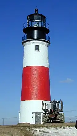
Sandy Neck Light
 US Coast Guard photo | |
| Location | Barnstable, Massachusetts |
|---|---|
| Coordinates | 41°43′22″N 70°16′52″W / 41.72278°N 70.28111°W |
| Tower | |
| Constructed | 1826 |
| Height | 16 m (52 ft) |
| Shape | Cylindrical Stone Tower |
| Markings | White with black bands and lantern |
| Heritage | National Register of Historic Places contributing property |
| Fog signal | none |
| Light | |
| First lit | 1857 (current structure) |
| Deactivated | 1931-2007 |
| Focal height | 15 m (49 ft) |
| Lens | 5th order Fresnel lens (original) LED (current) |
| Range | 4 nautical miles (7.4 km; 4.6 mi) |
| Characteristic | Fl W 6s |
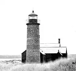
Sandy Neck Light is a lighthouse on Sandy Neck, in West Barnstable, Massachusetts, at the entrance to Barnstable Harbor.[1][2] It was first established in 1826. The current tower was built in 1857 and strengthened in the 1880s. It was discontinued in 1931, replaced by a skeleton tower, which was discontinued in 1952. The light was relit as a private aid to navigation in 2007.[3]
References
- ^ "Historic Light Station Information and Photography: Massachusetts". United States Coast Guard Historian's Office. 2009-09-02. Archived from the original on 2017-05-01.
- ^ United States Coast Guard (2009). Light List, Volume I, Atlantic Coast, St. Croix River, Maine to Shrewsbury River, New Jersey. p. 108.
- ^ Rowlett, Russ (2009-08-06). "Lighthouses of the United States: Southeast Massachusetts". The Lighthouse Directory. University of North Carolina at Chapel Hill.