Sant'Agapito
Sant'Agapito | |
|---|---|
| Comune di Sant'Agapito | |
.JPG) View of Sant'Agapito | |
Location of Sant'Agapito | |
 Sant'Agapito Location of Sant'Agapito in Italy 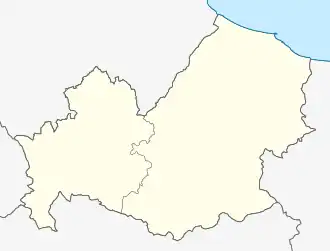 Sant'Agapito Sant'Agapito (Molise) | |
| Coordinates: 41°33′N 14°13′E / 41.550°N 14.217°E | |
| Country | Italy |
| Region | Molise |
| Province | Isernia (IS) |
| Frazioni | Colannoni, Coriemano, Pietradonata, Scalo Ferroviario, Temennotte |
| Government | |
| • Mayor | Giuseppe Di Pilla |
| Area | |
• Total | 15.93 km2 (6.15 sq mi) |
| Elevation | 565 m (1,854 ft) |
| Population (30 September 2016)[2] | |
• Total | 1,509 |
| • Density | 95/km2 (250/sq mi) |
| Demonym | Santagapitesi |
| Time zone | UTC+1 (CET) |
| • Summer (DST) | UTC+2 (CEST) |
| Postal code | 86070 |
| Dialing code | 0865 |
| Website | Official website |
Sant'Agapito is a comune (municipality) in the Province of Isernia in the Italian region Molise, located about 40 kilometres (25 mi) west of Campobasso and about 6 kilometres (4 mi) south of Isernia.
Sant'Agapito borders the following municipalities: Isernia, Longano, Macchia d'Isernia and Monteroduni.
References
- ^ "Superficie di Comuni Province e Regioni italiane al 9 ottobre 2011". Italian National Institute of Statistics. Retrieved 16 March 2019.
- ^ All demographics and other statistics: Italian statistical institute Istat.
External links
![]() Media related to Sant'Agapito (comune, Italy) at Wikimedia Commons
Media related to Sant'Agapito (comune, Italy) at Wikimedia Commons