Sant'Angelo Le Fratte
Sant'Angelo Le Fratte | |
|---|---|
| Comune di Sant'Angelo Le Fratte | |
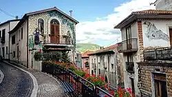 View of Sant'Angelo Le Fratte | |
.svg.png) Sant'Angelo Le Fratte within the Province of Potenza | |
Location of Sant'Angelo Le Fratte | |
 Sant'Angelo Le Fratte Location of Sant'Angelo Le Fratte in Italy 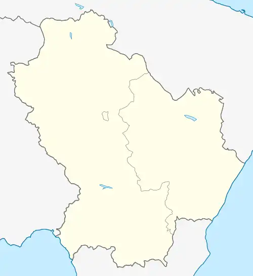 Sant'Angelo Le Fratte Sant'Angelo Le Fratte (Basilicata) | |
| Coordinates: 40°32′49″N 15°33′27″E / 40.54694°N 15.55750°E | |
| Country | Italy |
| Region | Basilicata |
| Province | Potenza (PZ) |
| Frazioni | Farisi, Isca, Santa Maria Fellana, San Vito |
| Area | |
• Total | 23 km2 (9 sq mi) |
| Elevation | 560 m (1,840 ft) |
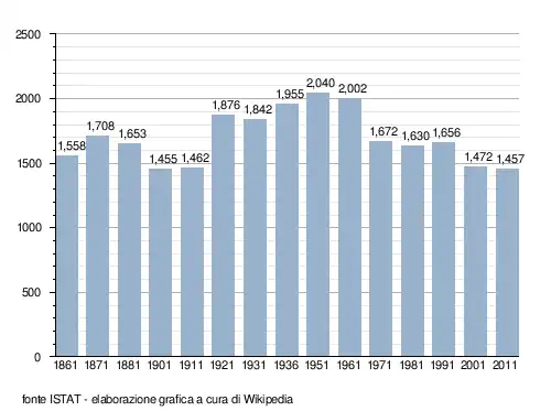
| Population (2011)[2] | |
• Total | 1,457 |
| • Density | 63/km2 (160/sq mi) |
| Demonym | Santangiolesi |
| Time zone | UTC+1 (CET) |
| • Summer (DST) | UTC+2 (CEST) |
| Postal code | 85050 |
| Dialing code | 0975 |
| ISTAT code | 076079 |
| Patron saint | San Michele Arcangelo |
| Saint day | 29 September |
| Website | Official website |
Sant'Angelo Le Fratte is a town and comune in the province of Potenza, in the Southern Italian region of Basilicata. As of 2011 its population was of 1,457.[2]
Geography
Located near the borders with Campania, Sant'Angelo is bounded by the comuni of Brienza, Caggiano (SA), Polla (SA), Satriano di Lucania, Savoia di Lucania, and Tito.[3] It counts the hamlets (frazioni) of Farisi, Isca, Santa Maria Fellana, and San Vito.
Demographics
References
- ^ "Superficie di Comuni Province e Regioni italiane al 9 ottobre 2011". Italian National Institute of Statistics. Retrieved 16 March 2019.
- ^ a b (in Italian) Source: Istat 2011
- ^ 40577 Sant'Angelo Le Fratte on OpenStreetMap
External links
![]() Media related to Sant'Angelo Le Fratte at Wikimedia Commons
Media related to Sant'Angelo Le Fratte at Wikimedia Commons
- (in Italian) Sant'Angelo Le Fratte official website