Savinja and Šalek Valley
Savinja and Šalek Valley
Savinjska in Šaleška dolina SAŠA region | |
|---|---|
Region | |
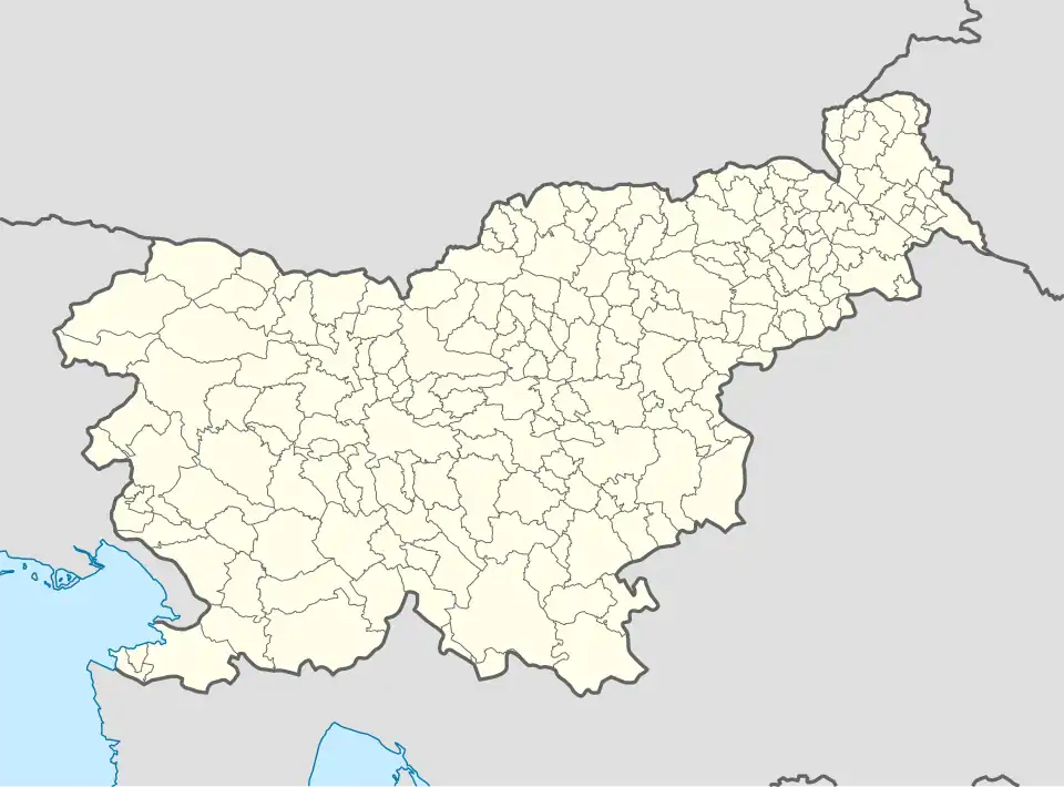 Savinja and Šalek Valley Location in Slovenia | |
| Coordinates: 46°21′45″N 15°06′52″E / 46.36250°N 15.11444°E | |
| Area | |
• Total | 705.6 km2 (272.4 sq mi) |
| Elevation | 400 m (1,300 ft) |
| Population (2013) | |
• Total | 61,442 |
| • Density | 87.1/km2 (226/sq mi) |
| Time zone | UTC+01:00 (CET) |
| • Summer (DST) | UTC+02:00 (CEST) |
| Postal code | 3331 |
| Area code | 03 (+386 3 from abroad) |
| Google Maps | Velenje, Slovenia |
| Website | www |
The Savinja and Šalek Valley (Slovene: Savinjska in Šaleška dolina) is a region in northern Slovenia, close to the border with Austria.[1]
Municipalities: Gornji Grad, Solčava, Rečica ob Savinji, Ljubno ob Savinji, Luče, Nazarje, Šmartno ob Paki, Mozirje, Šoštanj, and Velenje.
The main tourist destinations in the area:
- Nature Parks: the Logar Valley, the Roban Cirque (Slovene: Robanov kot), the Matk Cirque (Slovene: Matkov kot), Golte
- Golte ski and hiking area
- Solčava Panoramic Road
- City of Velenje
- Topolšica Spa
Natural wonders and cultural sights
-
 Velenje Castle in the Savinja and Šalek Valley
 -
 Thousands of flowers in Mozirski Gaj Flower Park
 -
 Luče is a good starting point for hiking
 -
 The Savinja River
 -
 The Upper Savinja Valley has a strong tradition of wood
 -
 The top of Rogatec
 -
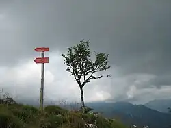
 Hiking near Lepenatka and Rogatec
 -
 Mount Raduha in the Savinja and Šalek Valley
 -
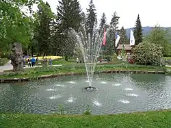 Fountain in the Mozirski Gaj Flower Park
See also
References
- ^ Pavšek, Miha (2007). "Šaleška in Zgornja Savinjska dolina". Geografski Zbornik. 54 (1): 22. Retrieved August 7, 2024.