Sawa (river)
| Sawa | |
|---|---|
 | |
| Location | |
| Country | Poland |
| Voivodeships | Subcarpathian |
| Settlements | Handzlówka, Albigowa, Wysoka, Sonina, Głuchów, Łańcut |
| Physical characteristics | |
| Source | |
| • location | Dynów Foothills near Husów, Handzlówka, and Błędowa Tyczyńska |
| Mouth | Wisłok |
• location | Near Łańcut |
• coordinates | 50°06′45″N 22°17′56″E / 50.11256°N 22.29892°E |
• elevation | 179,3 m |
| Length | 22.95 km (14.26 mi) |
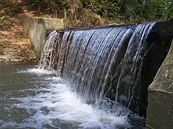
Sawa, also known as Głuchówka,[1] is a small river in Subcarpathian Voivodeship, Poland.[2]
Description
Its spring is located in Dynów Foothills near the villages of Husów, Handzlówka, and Błędowa Tyczyńska, and it tributes into the Wisłok river, near Łańcut.[2] Its length is 22.95 km.[3] The settlements located at the river are: Handzlówka, Albigowa, Wysoka, Sonina, Głuchów, and Łańcut.[3][2]
References
- ^ Sawa in Geoportal Polskiej Infrastruktury Informacji Przestrzennej, Główny Geodeta Kraju, in: Nazwy geograficzne Rzeczypospolitej Polskiej, PPWK, Warsaw 1991
- ^ a b c Nazewnictwo geograficzne Polski, vol. 1 Tom 1. Hydronimy, part 1. Wody płynące, źródła, wodospady. Główny Urząd Geodezji i Kartografii. p. 249.
- ^ a b Sawa in Geoportal Krajowego Zarządu Gospodarki Wodnej, module: Obszary Dorzeczy. Krajowy Zarząd Gospodarki Wodnej.