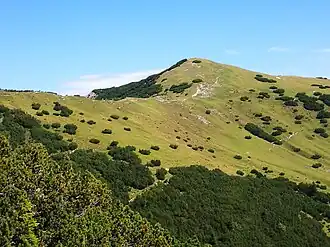
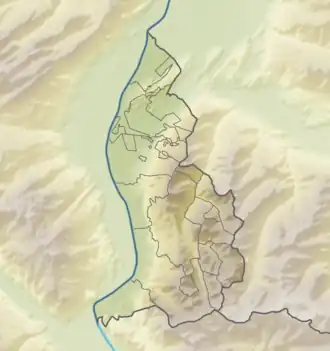
Schönberg (Liechtenstein)
| Schönberg | |
|---|---|
 Schönberg | |
| Highest point | |
| Elevation | 2,104 m (6,903 ft) |
| Coordinates | 47°07′49.3″N 9°35′34.6″E / 47.130361°N 9.592944°E |
| Geography | |
 Schönberg | |
| Parent range | Rätikon, Alps |
Schönberg (German pronunciation: [ˈʃøːnˌbɛʁk] ⓘ) is a mountain in Liechtenstein in the Rätikon range of the Eastern Alps north-east of the village of Steg, with a height of 2,104 metres (6,903 ft).
References
- Unfolding Liechtenstein, Panorama Map (Map). Liechtenstein Tourismus. 2007.
- Feldkirch - Vaduz (Map). 1:50000. Wander, Bike- und Skitourenkarte. Cartography by Kompass-Karten GmbH. Kompass. 2007.