Scrofiano
Scrofiano | |
|---|---|
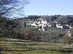 A view of Scrofiano | |
.svg.png) Location of Sinalunga in the Province of Siena | |
 Scrofiano Location of Scrofiano in Italy | |
| Coordinates: 43°13′51″N 11°42′56″E / 43.23083°N 11.71556°E | |
| Country | Italy |
| Region | |
| Province | Siena |
| Comune | Sinalunga |
| Elevation | 374 m (1,227 ft) |
| Population (2001) | |
• Total | 247 |
| Demonym(s) | Scrofianese, -i |
| Time zone | UTC+1 (CET) |
| • Summer (DST) | UTC+2 (CEST) |
| Postal code | 53048 |
| Dialing code | 0577 |
| Patron saint | St. Blaise |
| Saint day | February 3 |
Scrofiano is a village in Tuscany, central Italy,[1] a frazione of the comune of Sinalunga in the province of Siena. It is located on a hill in Val di Chiana, a few kilometers from Sinalunga proper.
Scrofiano was founded in around the 11th century. It is known however with certainty from the 12th century, when it was a fief of the Cacciaconti family, as part of the Republic of Siena. In the early 15th century it was the seat of a decisive battle between the Ghibelline Sienese and the Guelph Florentines.
In 1554 its castle was besieged by the Imperial-Florentine troops, which destroyed its walls.
Main sights
- Torre del Cassero (12th century)
- Palazzo Comunale (14th-15th centuries)
- The Collegiata di San Biagio church (13th century), housing a canvas by Santi di Tito portraying the Pietà with St. Francis (c. 1580).
- The church of the Company of San Salvatore is also home to a work by Santi di Tito.