Seira, Aragon
Seira | |
|---|---|
| Country | Spain |
| Autonomous community | Aragon |
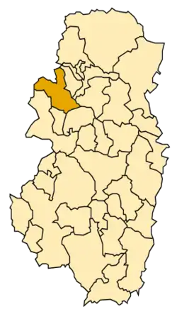
| Province | Huesca |
| Comarca | Ribagorza (comarca) |
| Area | |
• Total | 69.4 km2 (26.8 sq mi) |
| Elevation | 810 m (2,660 ft) |
| Population (2018)[1] | |
• Total | 150 |
| Demonym(s) | Seirano, Seirana |
| Time zone | UTC+1 (CET) |
| • Summer (DST) | UTC+2 (CEST) |
Seira (Spanish: [ˈsejɾa]; locally [ˈsejɾa]) is a municipality located in the Ribagorza comarca, province of Huesca, Aragon, Spain. According to the 2018 census the municipality has a population of 150 inhabitants.[2] Its postal code is 22463.
The town is located on the left side of the Ésera River in a very mountainous place.
See also
References
- ^ Municipal Register of Spain 2018. National Statistics Institute.
- ^ Instituto Nacional de Estadística (Spain)
External links
Wikimedia Commons has media related to Seira.
Municipalities of Ribagorza | ||
|---|---|---|
| ||
1Capital of the comarca 2Former-historical capital of the comarca | ||
42°28′49″N 00°25′48″W / 42.48028°N 0.43000°W
auto