Serri, Sardinia
Serri | |
|---|---|
| Comune di Serri | |
Location of Serri | |
 Serri Location of Serri in Sardinia 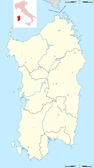 Serri Serri (Sardinia) | |
| Coordinates: 39°42′N 9°9′E / 39.700°N 9.150°E | |
| Country | Italy |
| Region | Sardinia |
| Province | South Sardinia |
| Area | |
• Total | 19.1 km2 (7.4 sq mi) |
| Population (Dec. 2004)[1] | |
• Total | 725 |
| • Density | 38/km2 (98/sq mi) |
| Time zone | UTC+1 (CET) |
| • Summer (DST) | UTC+2 (CEST) |
| Postal code | 08030 |
| Dialing code | 0782 |
Serri (Latin: Biora[2]) is a comune (municipality) in the Province of South Sardinia in the Italian region Sardinia, located about 50 kilometres (31 mi) north of Cagliari. As of 31 December 2004, it had a population of 725 and an area of 19.1 square kilometres (7.4 sq mi).[3]
Serri borders the following municipalities: Escolca, Gergei, Isili, Mandas, Nurri.
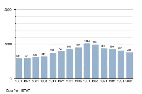
Demographic evolution
References
Wikimedia Commons has media related to Serri.
- ^ "Popolazione Residente al 1° Gennaio 2018". Italian National Institute of Statistics. Retrieved 16 March 2019.
- ^ Richard Talbert, Barrington Atlas of the Greek and Roman World, (ISBN 0-691-03169-X), Map 48.
- ^ All demographics and other statistics: Italian statistical institute Istat.