Settala
Settala
Settara (Lombard) | |
|---|---|
| Comune di Settala | |
 Coat of arms | |
Location of Settala | |
 Settala Location of Settala in Italy 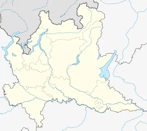 Settala Settala (Lombardy) | |
| Coordinates: 45°27′N 9°23′E / 45.450°N 9.383°E | |
| Country | Italy |
| Region | Lombardy |
| Metropolitan city | Milan (MI) |
| Frazioni | Premenugo, Caleppio |
| Area | |
• Total | 17.5 km2 (6.8 sq mi) |
| Population (Dec. 2004)[2] | |
• Total | 6,460 |
| • Density | 370/km2 (960/sq mi) |
| Demonym | Settalesi |
| Time zone | UTC+1 (CET) |
| • Summer (DST) | UTC+2 (CEST) |
| Postal code | 20049 |
| Dialing code | 02 |
| Website | Official website |
Settala (Lombard: Settara [seˈtaːra]) is a comune (municipality) in the Province of Milan in the Italian region Lombardy, located about 15 kilometres (9 mi) east of Milan. As of 31 December 2004, it had a population of 6,460 and an area of 17.5 square kilometres (6.8 sq mi).[3]
The municipality of Settala contains the frazioni (subdivisions, mainly villages and hamlets) Premenugo and Caleppio.
Settala borders the following municipalities: Vignate, Rodano, Liscate, Comazzo, Merlino, Pantigliate, Paullo, Mediglia.
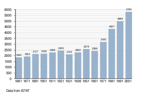
Demographic evolution
References
- ^ "Superficie di Comuni Province e Regioni italiane al 9 ottobre 2011". Italian National Institute of Statistics. Retrieved 16 March 2019.
- ^ "Popolazione Residente al 1° Gennaio 2018". Italian National Institute of Statistics. Retrieved 16 March 2019.
- ^ All demographics and other statistics: Italian statistical institute Istat.
External links