Sevron
| Sevron | |
|---|---|
 | |
  | |
| Location | |
| Country | France |
| Physical characteristics | |
| Source | |
| • location | Meillonnas |
| • coordinates | 46°14′52″N 05°22′22″E / 46.24778°N 5.37278°E |
| • elevation | 360 m (1,180 ft) |
| Mouth | |
• location | Solnan |
• coordinates | 46°31′59″N 05°16′08″E / 46.53306°N 5.26889°E |
• elevation | 180 m (590 ft) |
| Length | 54.7 km (34.0 mi) |
| Basin size | 195 km2 (75 sq mi) |
| Discharge | |
| • average | 3.16 m3/s (112 cu ft/s) |
| Basin features | |
| Progression | Solnan→ Seille→ Saône→ Rhône→ Mediterranean Sea |
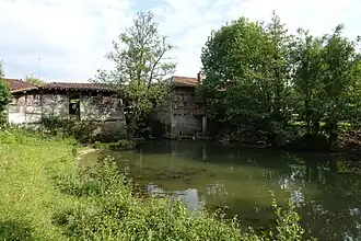
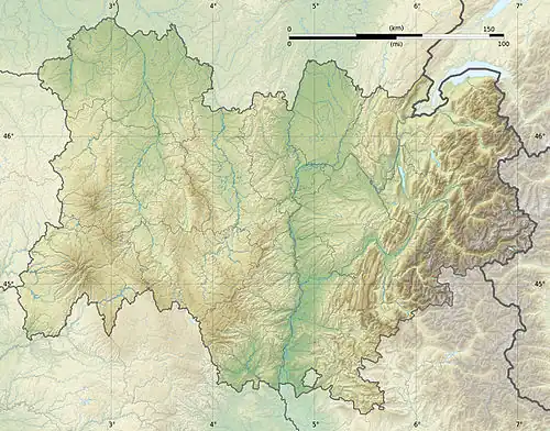
The Sevron (French pronunciation: [səvʁɔ̃]) is a 54.7-kilometre (34.0 mi) long river in the Ain and Saône-et-Loire departments, eastern France.[1] Its source is in Meillonnas. It flows generally north-northwest. It is a left tributary of the Solnan, into which it flows at Varennes-Saint-Sauveur.
Departments and communes along its course
This list is ordered from source to mouth:
- Ain: Meillonnas, Treffort-Cuisiat, Saint-Étienne-du-Bois, Bény, Marboz, Pirajoux, Beaupont, Cormoz,
- Saône-et-Loire: Varennes-Saint-Sauveur,
References