Shaghap
39°52′N 44°54′E / 39.867°N 44.900°E
Shaghap
Շաղափ | |
|---|---|
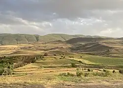 Mountains near Shaghap | |
 Shaghap  Shaghap | |
| Coordinates: 39°52′N 44°54′E / 39.867°N 44.900°E | |
| Country | Armenia |
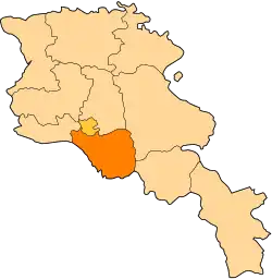
| Province | Ararat |
| Municipality | Vedi |
| Elevation | 1,300 m (4,300 ft) |
| Population (2011) | |
• Total | 913[1] |
| Time zone | UTC+4 |
| • Summer (DST) | UTC+5 |
Shaghap (Armenian: Շաղափ) is a village in the Vedi Municipality of the Ararat Province of Armenia.
References
- ^ "Ararat (Armenia): Towns and Villages in Municipalities". www.citypopulation.de. Retrieved 2024-11-21.
- Shaghap at GEOnet Names Server
- Report of the results of the 2001 Armenian Census, Statistical Committee of Armenia