Simonsberg
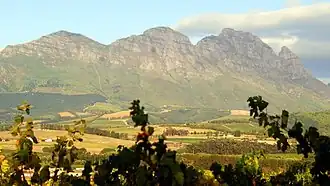
Simonsberg (English: Simon's Mountain) is part of the Cape Fold Belt in the Western Cape province of South Africa. It is located between the towns of Stellenbosch, Paarl and Franschhoek, forming a prominent 1390 m high mountain, as it is detached from the other ranges in the winelands region. A hiking trail leads to the summit, as well as to one of the other peaks. The trail is accessible from a neighbouring wine farm.
| Simonsberg | |
|---|---|
 | |
| Highest point | |
| Elevation | 1,390 m (4,560 ft)[1] |
| Prominence | 1,011 m (3,317 ft) |
| Listing | Ribu |
| Coordinates | 34°01′S 19°03′E / 34.017°S 19.050°E |
| Naming | |
| Etymology | Named after the first governor of the Cape Colony, Simon van der Stel |
| Geography | |
 Simonsberg | |
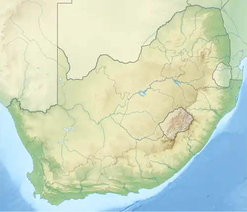
| Country | South Africa |
| State | Western Cape |
| Settlement | Stellenbosch |
Simonsberg is named after Simon van der Stel, first governor of the Cape and founder and namesake of Stellenbosch and Simon's Town. The mountain has 7 caves as part of a mining project for silver.
References
- ^ "World Ribus – Southern Africa". World Ribus. Retrieved 26 December 2024.
External links
- "Stellenbosch Wine Routes". Retrieved 6 March 2010.
- The Rootstock Blogspot: Simonsberg: Mountain of Women