Skibergfjellet
| Skibergfjellet | |
|---|---|
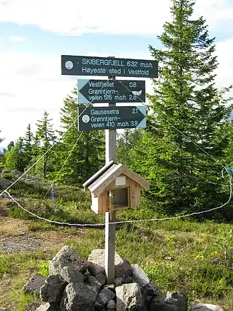 Sign on the top of Skibergfjellet | |
| Highest point | |
| Elevation | 632 m (2,073 ft)[1] |
| Prominence | 17 m (56 ft)[1] |
| Isolation | 0.442 km (0.275 mi)[1] |
| Coordinates | 59°34′54″N 9°58′10″E / 59.58178°N 9.96958°E[2] |
| Geography | |
 Skibergfjellet Location of the mountain 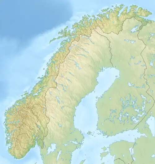 Skibergfjellet Skibergfjellet (Norway) | |
| Location | Vestfold, Norway |
| Topo map(s) | 1714 II Kongsberg (west) and 1814 III Drammen (east) |
Skibergfjellet is a mountain in Holmestrand Municipality in Vestfold county, Norway. The 632-metre (2,073 ft) tall mountain is located about 4 kilometres (2.5 mi) west of the village of Eidsfoss and about 9 kilometres (5.6 mi) northwest of the village of Hof.[1]
The mountain is surrounded by several other notable mountains including Vestfjellet and Grøntjernkollen to the southwest and Buaren to the south.[1] Views from the peak include Færder Lighthouse, Tryvannstårnet, Norefjell, and Jonsknuten.[3]
See also
References