Sodam
Sodam | |
|---|---|
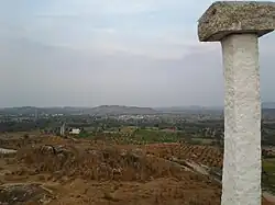 Aerial view of Sodam seen from Seethamma Gutta. | |
Dynamic map | |
.svg.png) Sodam Location in Andhra Pradesh, India | |
| Coordinates: 13°32′51″N 78°54′27″E / 13.54750°N 78.90750°E | |
| Country | India |
| State | Andhra Pradesh |
| District | Chittoor |
| Mandal | Sodam |
| Government | |
| • Type | Panchayath |
| • Body | Sarpanch |
| Area | |
• Total | 3.04 km2 (1.17 sq mi) |
| Population (2011) | |
• Total | 6,995 |
| • Density | 2,300/km2 (6,000/sq mi) |
| Languages | |
| • Official | Telugu |
| Time zone | UTC+5:30 (IST) |
| PIN | 517123 |
| Vehicle registration | AP03, AP39 |
| Educational institutions | ZP High school, Vinayaka Degree College |
| Nearest city | Pileru |
| Vidhan Sabha Constituency | Punganur |
| Lok Sabha Constituency | Rajampeta |
| RTO | AP403-Piler MVI Office |
Sodam is a mandal in Palamaner Revenue Division of Chittoor district in the southern Indian state of Andhra Pradesh.[1]
References
Wikimedia Commons has media related to Sodam.
- ^ "Basic Population Figures of India, States, Districts, Sub-District and Village, 2011". censusindia.gov.in. Ministry of Home Affairs. 2011. Archived from the original on 11 July 2022. Retrieved 18 May 2025.