Som Sa-at
Som Sa-at
สมสะอาด | |
|---|---|
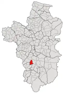 Subdistrict location in Ubon Ratchathani province | |
| Country | Thailand |
| Province | Ubon Ratchathani |
| District | Det Udom |
| Mubans | 12 |
| Number of Mu | 13 |
| Subdistrict established | 1892 |
| Area | |
• Total | 56 km2 (22 sq mi) |
| Population (2021) | |
• Total | 10,882 |
| • Density | 194.32/km2 (503.3/sq mi) |
| Time zone | UTC+7 (ICT) |
| Postal code | 34160 |
Som Sa-at (Thai: สมสะอาด) is a tambon (subdistrict) located in the mid-west region of Det Udom District, in Ubon Ratchathani Province, Thailand.[1][2][3] In 2021, it had a population of 10,882 people.[2] Neighbouring subdistricts are (clockwise from the south) Non Sombun, Na Kasem, Nong Om, Na Krasaeng, Na Charoen, and Tha Pho Si.[3]
History
Before 1997, Som Sa-ad tambon was governed by its subdistrict council, but such a local government has been promoted to the Subdistrict Administrative Organization of Som Sa-at (องค์การบริหารส่วนตำบลสมสะอาด; Som Sa-at SAO) in February 1997, the first subdistrict member court election happened in May that year.[4]
In 1961, together with the area divided from Kaeng, its western area which consisted of seven villages was split off to form a new subdistrict, Thung Thoeng.[1]
In 1966, together with the area divided from Na Suang and Thung Thoeng, the northern region of the tambon was split to form a new subdistrict, Na Charoen.[5]
Geography
The tambon is located in the mid-west region of the Det Udom district, on the river plain of the Lam Dom Yai River.[3]
Administration
Som Sa-at subdistrict is divided into 12 administrative villages (mubans; หมู่บ้าน), one of which, Muang village, was further divided into two community groups (Mu; หมู่).[2] The entire area is governed by the Subdistrict Administrative Organization of Som Sa-at (องค์การบริหารส่วนตำบลสมสะอาด; Som Sa-at SAO).[2]
The following is a list of the subdistrict's mubans, which roughly correspond to the villages, as of the 2021 census.[2]
| Village | Group (Mu) |
Household | Population | |
|---|---|---|---|---|
| Romanized name | Thai name | |||
| Som Sa-at | สมสะอาด | 1 |
354 |
1,197
|
| Ta Luang | ท่าหลวง | 2 |
251 |
885
|
| Muang | ม่วง | 3 |
338 |
957
|
10 |
434 |
1,259
| ||
| Na Di | นาดี | 4 |
293 |
747
|
| Na Kham | นาคำ | 5 |
388 |
959
|
| Non Sanam | โนนสนาม | 6 |
375 |
886
|
| Suan Phai | สวนฝ้าย | 7 |
250 |
821
|
| Nong Bua Luang | หนองบัวหลวง | 8 |
211 |
685
|
| Huai Aree | ห้วยอารีย์ | 9 |
230 |
841
|
| Rat Samran | ราษฎร์สำราญ | 11 |
119 |
361
|
| Mai Charoen | ใหม่เจริญ | 12 |
196 |
663
|
| Muang Samakki | ม่วงสามัคคี | 13 |
176 |
621
|
| Total | 3,615 |
10,882
| ||
References
- ^ a b "ประกาศกระทรวงมหาดไทย เรื่อง ตั้งและเปลี่ยนแปลงเขตตำบลในท้องที่อำเภอเดชอุดม อำเภอตระการพืชผล และอำเภอเขมราฐ จังหวัดอุบลราชธานี" (PDF). www.ratchakitcha.soc.go.th (in Thai). Royal Thai Government Gazette. 25 May 1961. Archived from the original (PDF) on 26 October 2021. Retrieved 16 December 2022.
- ^ a b c d e "โครงสร้างข้อมูลสถิติจำนวนประชากร" (in Thai). Department of Provincial Administration of Thailand. 2021. Archived from the original on 14 December 2022. Retrieved 15 December 2022. Alt URL
- ^ a b c "สภาพทั่วไป". www.somsaad.go.th (in Thai). Subdistrict Administrative Organization of Som Sa-ad. Archived from the original on 21 June 2022. Retrieved 16 December 2022.
- ^ "ประวัติความเป็นมา". www.somsaad.go.th (in Thai). Subdistrict Administrative Organization of Som Sa-at. Archived from the original on 21 June 2022. Retrieved 16 December 2022.
- ^ "ประกาศกระทรวงมหาดไทย เรื่อง ตั้งและเปลี่ยนแปลงเขตตำบล ในท้องที่อำเภอเดชอุดม จังหวัดอุบลราชธานี" (PDF). www.ratchakitcha.soc.go.th (in Thai). Royal Thai Government Gazette. 13 September 1966. Archived from the original (PDF) on 1 August 2019. Retrieved 15 December 2022.