Spånga-Tensta
Spånga-Tensta | |
|---|---|
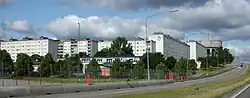 View of Tensta | |
 Location within Stockholm | |
| Coordinates: 59°23′39″N 17°54′04″E / 59.39417°N 17.90111°E | |
| Country | |
| Municipality | Stockholm |
| Municipal part | Västerort |
| Established | 1997 |
| Area | |
• Total | 12.85 km2 (4.96 sq mi) |
| Population (2014) | |
• Total | 39,082 |
| • Density | 3,000/km2 (7,900/sq mi) |
| Website | Spånga-Tensta at stockholm.se |
Spånga-Tensta was a borough (stadsdelsområde) located in Västerort in the western part of Stockholm, Sweden. The districts that make up the borough are Bromsten, Flysta, Lunda, Solhem, Sundby and Tensta. A large portion of Järvafältet is also located in Spånga-Tensta as well as in the districts of Akalla and Husby in neighboring Rinkeby-Kista borough.[1][2][3]
The borough includes of the community of Spånga. The population as of 2004 is 34,448 on an area of 12.85 km2, which gives a density of 2,680.78/km2.
Transport
The transport provided is:
- Rail: The Blue Line of the Stockholm Metro, running from Kungsträdgården in the city centre to Hjulsta station in the north west. It has two stations in the borough of Spånga-Tensta, Hjulsta and Tensta, both inaugurated in 1975. Commuter rail has one station, Spånga Station.
- Bus: Several bus routes serve the borough.
- Car: E18/Hjulstavägen runs on the north of Hjulsta and Tensta. When finished, the Förbifart Stockholm motorway will connect to E18 at Hjulsta.
References
- ^ "Spånga-Tensta". Stockholms Stad. Retrieved February 1, 2020.
- ^ "Tensta". Stockholms Stad. Retrieved February 1, 2020.
- ^ "Järvafältet". Stockholms Stad. Retrieved February 1, 2020.
External links
![]() Media related to Spånga-Tensta at Wikimedia Commons
Media related to Spånga-Tensta at Wikimedia Commons
| |||