Spencerville, Maryland
Spencerville, Maryland | |
|---|---|
 Spencerville  Spencerville | |
| Coordinates: 39°07′26″N 76°58′50″W / 39.12389°N 76.98056°W | |
| Country | |
| State | |
| County | |
| Area | |
• Total | 1.56 sq mi (4.05 km2) |
| • Land | 1.56 sq mi (4.04 km2) |
| • Water | 0.00 sq mi (0.01 km2) |
| Elevation | 535 ft (163 m) |
| Population | |
• Total | 1,812 |
| • Density | 1,160.05/sq mi (447.99/km2) |
| Time zone | UTC−5 (Eastern (EST)) |
| • Summer (DST) | UTC−4 (EDT) |
| ZIP code | 20868 |
| Area codes | 240 & 301 |
| GNIS feature ID | 2583689[2] |
| FIPS code | 24-74050 |
Spencerville is an unincorporated community and census-designated place in Montgomery County, Maryland, United States. Spencerville is 1 mile (1.6 km) north of Cloverly. Spencerville has a post office with ZIP code 20868.[4] As of the 2020 census, the population was 1,812.[3]
Demographics
| Census | Pop. | Note | %± |
|---|---|---|---|
| 2010 | 1,594 | — | |
| 2020 | 1,812 | 13.7% | |
| U.S. Decennial Census[5] 2010[6] | |||
Spencerville first appeared as a census designated place in the 2010 U.S. Census formed from part of Cloverly CDP and additional area.[6]
References
Wikimedia Commons has media related to Spencerville, Maryland.
- ^ "2022 U.S. Gazetteer Files: Maryland". United States Census Bureau. Retrieved June 7, 2023.
- ^ a b U.S. Geological Survey Geographic Names Information System: Spencerville, Maryland
- ^ a b "P1. Race – Spencerville CDP, Maryland: 2020 DEC Redistricting Data (PL 94-171)". U.S. Census Bureau. Retrieved June 7, 2023.
- ^ "Free ZIP Code Lookup with area code, county, geocode, MSA/PMSA, population". www.zipinfo.com.
- ^ "Decennial Census of Population and Housing by Decades". US Census Bureau.
- ^ a b "2010 Census of Population - Population and Housing Unit Counts - Maryland" (PDF). United States Census Bureau.
Municipalities and communities of Montgomery County, Maryland, United States | ||
|---|---|---|
| Cities | 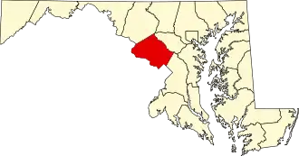 | |
| Towns | ||
| Villages & Special Tax Districts | ||
| CDPs |
| |
| Other communities | ||
| Footnotes | ‡This populated place also has portions in an adjacent county or counties | |