Spilaio
Spilaio
Σπήλαιο | |
|---|---|
 Spilaio | |
| Coordinates: 41°39′N 26°19′E / 41.650°N 26.317°E | |
| Country | Greece |
| Administrative region | East Macedonia and Thrace |
| Regional unit | Evros |
| Municipality | Orestiada |
| Municipal unit | Trigono |
| Population (2021)[1] | |
• Community | 230 |
| Time zone | UTC+2 (EET) |
| • Summer (DST) | UTC+3 (EEST) |
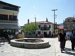
Spilaio (Greek: Σπήλαιο meaning cave) is a village in the northern part of the Evros regional unit in Greece. It is in the municipal unit of Trigono. It is in a relatively flat, agricultural area. The nearest larger villages are Dikaia to its north, and Plati to its southeast.
Population
| Year | Population |
|---|---|
| 1981 | 603 |
| 1991 | 590 |
| 2001 | 443 |
| 2011 | 334 |
| 2021 | 230 |
History
The village was founded by the Ottoman Turks, it was known as İspitli then. After a brief period of Bulgarian rule between 1913 and 1919, it became part of Greece. As a result its Bulgarian and Turkish population was exchanged with Greek refugees, mainly from today's Turkey.
See also
References
- ^ "Αποτελέσματα Απογραφής Πληθυσμού - Κατοικιών 2021, Μόνιμος Πληθυσμός κατά οικισμό" [Results of the 2021 Population - Housing Census, Permanent population by settlement] (in Greek). Hellenic Statistical Authority. 29 March 2024.