Squirrel River
| Squirrel River | |
|---|---|
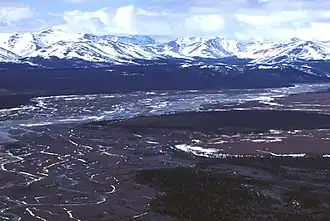 Squirrel River with Baird Mountains | |
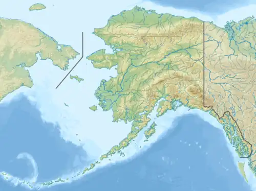 Location of the mouth of the Squirrel River in Alaska | |
| Native name | Siksriktuum Kuuŋa (Inupiaq) |
| Location | |
| Country | United States |
| State | Alaska |
| Borough | Northwest Arctic |
| Physical characteristics | |
| Source | Baird Mountains |
| • coordinates | [1] |
| Mouth | Kobuk River |
• location | 28 miles (45 km) northwest of Selawik |
• coordinates | 66°59′00″N 160°24′00″W / 66.98333°N 160.40000°W[1] |
• elevation | 30 ft (9.1 m)[1] |
| Length | 72 mi (116 km)[2] |
The Squirrel River (Iñupiaq: Siksriktuum Kuuŋa, Koyukon: Tleleyh No’) is a 72-mile (116 km) tributary of the Kobuk River in the U.S. state of Alaska.[2] It is a very clear, small arctic river flowing south from the foothills of Baird Mountains to where it meets the Kobuk River in the village of Kiana.[3] From Kiana, the Kobuk flows southwest into Hotham Inlet of Kotzebue Sound on the Chukchi Sea.[3]
The upper segment of the stream runs in a U molded, half-mile wide valley lying between 300-to 400-foot moving slopes. The lower area of stream has a rough track along the north bank that approaches some mining claims on Klery Creek.
See also
References
- ^ a b c "Squirrel River". Geographic Names Information System. United States Geological Survey. March 23, 2001. Retrieved September 16, 2013.
- ^ a b Orth, Donald J.; United States Geological Survey (1971) [1967]. Dictionary of Alaska Place Names: Geological Survey Professional Paper 567 (PDF). University of Alaska Fairbanks. p. 912. Archived from the original (PDF) on October 17, 2013. Retrieved September 16, 2013 – via United States Government Printing Office.
- ^ a b Alaska Atlas & Gazetteer (7th ed.). Yarmouth, Maine: DeLorme. 2010. p. 133. ISBN 978-0-89933-289-5.