St. Francisville, Missouri
St. Francisville, Missouri | |
|---|---|
| Coordinates: 40°26′59″N 91°34′19″W / 40.44972°N 91.57194°W | |
| Country | United States |
| State | Missouri |
| County | Clark |
| Area | |
• Total | 1.91 sq mi (4.95 km2) |
| • Land | 1.86 sq mi (4.81 km2) |
| • Water | 0.05 sq mi (0.14 km2) |
| Elevation | 633 ft (193 m) |
| Population (2020) | |
• Total | 137 |
| • Density | 73.70/sq mi (28.46/km2) |
| ZIP code | 63472[3] |
| Area code | 660 |
| FIPS code | 29-64244 |
| GNIS feature ID | 2587112[2] |
St. Francisville or Saint Francisville is an unincorporated community and census-designated place in northeast Clark County, Missouri, United States.[2] As of the 2020 census, its population was 137.[4]
The community is on Missouri Route B four miles north of Wayland. The Des Moines River and the Missouri-Iowa border are one-half mile north of the community.[5] It is the oldest settlement in Clark County, Missouri.
Etymology
St. Francisville was platted in 1833, by a man named Francis Church.[6]
Demographics
| Census | Pop. | Note | %± |
|---|---|---|---|
| 2020 | 137 | — | |
| U.S. Decennial Census[7] | |||
Education
It is in the Clark County R-I School District.[8] The district's comprehensive high school is Clark County High School.
References
- ^ "ArcGIS REST Services Directory". United States Census Bureau. Retrieved September 5, 2022.
- ^ a b c U.S. Geological Survey Geographic Names Information System: St. Francisville, Missouri
- ^ "St. Francisville MO ZIP Code". zipdatamaps.com. 2023. Retrieved June 16, 2023.
- ^ "2020: DEC Redistricting Data (PL 94-171)". United States Census Bureau. Retrieved November 17, 2021.
- ^ Missouri Atlas & Gazetteer, DeLorme, First edition, 1998, p. 17 ISBN 0899332242
- ^ Eaton, David Wolfe (1916). How Missouri Counties, Towns and Streams Were Named. The State Historical Society of Missouri. pp. 276.
- ^ "Census of Population and Housing". Census.gov. Retrieved June 4, 2016.
- ^ Geography Division (January 12, 2021). 2020 CENSUS - SCHOOL DISTRICT REFERENCE MAP: Clark County, MO (PDF) (Map). U.S. Census Bureau. Retrieved June 1, 2025. - Text list
Municipalities and communities of Clark County, Missouri, United States | ||
|---|---|---|
| Cities | 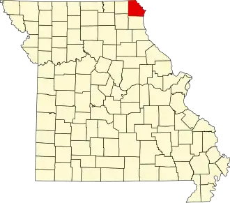 | |
| Villages | ||
| Townships | ||
| CDPs | ||
| Other communities | ||