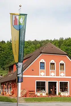
Stein, Styria
Stein | |
|---|---|
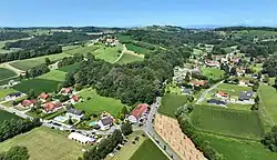 Aerial view of Stein | |
_COA.svg.png) Coat of arms | |
 Stein Location within Austria | |
| Coordinates: 46°59′58″N 16°05′04″E / 46.99944°N 16.08444°E | |
| Country | Austria |
| State | Styria |
| District | Hartberg-Fürstenfeld |
| Area | |
• Total | 7.33 km2 (2.83 sq mi) |
| Elevation | 320−360 m (−860 ft) |
| Population (1 January 2016)[1] | |
• Total | 495 |
| • Density | 68/km2 (170/sq mi) |
| Time zone | UTC+1 (CET) |
| • Summer (DST) | UTC+2 (CEST) |
| Postal code | 8282 |
| Area code | 03382 |
| Vehicle registration | FF |
| Website | www.stein.steiermark.at |
Stein (German pronunciation: [ʃtaɪn] ⓘ) is a former municipality in the district of Hartberg-Fürstenfeld in Styria, Austria. Since the 2015 Styria municipal structural reform, it is part of the municipality Loipersdorf bei Fürstenfeld.[2]
References