Strzegomka
| Strzegomka | |
|---|---|
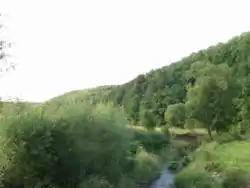 The Strzegomka in Chwaliszów | |
| Location | |
| Country | |
| Voivodeship | Lower Silesian |
| Physical characteristics | |
| Source | |
| • location | A slope of the Trójgarb and Krąglak Massif, in Wałbrzych County |
| • coordinates | 50°48′53.2″N 16°09′52.2″E / 50.814778°N 16.164500°E |
| • elevation | 636 m (2,087 ft) |
| Mouth | Bystrzyca |
• location | northwest of Samotwór, Wrocław County |
• coordinates | 51°06′23″N 16°49′47″E / 51.106439°N 16.829818°E |
• elevation | 121.1 m (397 ft) |
| Length | 74.70 km (46.42 mi) |
| Basin size | 555 km2 (214 sq mi) |
| Discharge | |
| • average | 3 m3/s (110 cu ft/s) at the mouth |
| Basin features | |
| Progression | Bystrzyca→ Oder→ Baltic Sea |
| Tributaries | |
| • right | Pełcznica |
The Strzegomka is a river of Poland, a tributary of the Bystrzyca in Samotwór. Before 1945, the river was known as the Striegau.