Sulmeck-Greith
Sulmeck-Greith | |
|---|---|
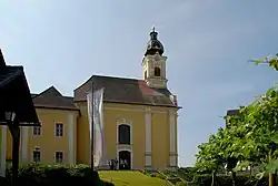 Parish church in Greith | |
 Coat of arms | |
 Sulmeck-Greith Location within Austria | |
| Coordinates: 46°44′00″N 15°19′00″E / 46.73333°N 15.31667°E | |
| Country | Austria |
| State | Styria |
| District | Deutschlandsberg |
| Area | |
• Total | 18.62 km2 (7.19 sq mi) |
| Elevation | 320 m (1,050 ft) |
| Population (1 January 2016)[1] | |
• Total | 1,318 |
| • Density | 71/km2 (180/sq mi) |
| Time zone | UTC+1 (CET) |
| • Summer (DST) | UTC+2 (CEST) |
| Postal code | 8443, 8543, 8544 |
| Area code | 3465 |
| Vehicle registration | DL |
| Website | www.sulmeck-greith.at |
Sulmeck-Greith is a former municipality in the district of Deutschlandsberg in the Austrian state of Styria. Since the 2015 Styria municipal structural reform, it is part of the municipality Sankt Martin im Sulmtal.[2]
Population
| Year | Pop. | ±% |
|---|---|---|
| 1869 | 1,432 | — |
| 1880 | 1,491 | +4.1% |
| 1890 | 1,497 | +0.4% |
| 1900 | 1,490 | −0.5% |
| 1910 | 1,396 | −6.3% |
| 1923 | 1,590 | +13.9% |
| 1934 | 1,537 | −3.3% |
| 1939 | 1,396 | −9.2% |
| 1951 | 1,491 | +6.8% |
| 1961 | 1,510 | +1.3% |
| 1971 | 1,510 | +0.0% |
| 1981 | 1,510 | +0.0% |
| 1991 | 1,545 | +2.3% |
| 2001 | 1,507 | −2.5% |
| 2011 | 1,367 | −9.3% |
References