Syresham Marshy Meadows
| Site of Special Scientific Interest | |
 | |
| Location | Northamptonshire |
|---|---|
| Grid reference | SP 640 425[1] |
| Interest | Biological |
| Area | 17.8 hectares[1] |
| Notification | 1985[1] |
| Location map | Magic Map |
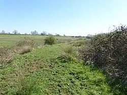
Syresham Marshy Meadows is a 17.8-hectare (44-acre) biological Site of Special Scientific Interest west of Silverstone in Northamptonshire.[1][2]
This site consists of two nearby areas of wetland in valleys which drain into the River Great Ouse. The northern one is a mire on shallow peat, and the southern one is agriculturally unimproved grassland and marsh on diverse soils, which has over a hundred flowering plant species.[3]
A footpath leads into the northern area, but there is no public access to the southern one.
References
- ^ a b c d "Designated Sites View: Syresham Marshy Meadows". Sites of Special Scientific Interest. Natural England. Retrieved 11 April 2017.
- ^ "Map of Syresham Marshy Meadows". Sites of Special Scientific Interest. Natural England. Retrieved 11 April 2017.
- ^ "Syresham Marshy Meadows citation" (PDF). Sites of Special Scientific Interest. Natural England. Retrieved 11 April 2017.
Wikimedia Commons has media related to Syresham Marshy Meadows.