Szanda
Szanda | |
|---|---|
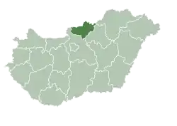
 Location of Nógrád county in Hungary | |
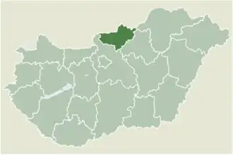
 Szanda Location of Szanda | |
| Coordinates: 47°55′37″N 19°26′18″E / 47.92689°N 19.43844°E | |
| Country | |
| County | Nógrád |
| Area | |
• Total | 21.49 km2 (8.30 sq mi) |
| Population (2004) | |
• Total | 707 |
| • Density | 32.89/km2 (85.2/sq mi) |
| Time zone | UTC+1 (CET) |
| • Summer (DST) | UTC+2 (CEST) |
| Postal code | 2697 |
| Area code | 35 |
Szanda is a village in Nógrád county, Hungary.
-

-

-

-

-

-
 Aerial photography of a castle in Szanda
External links
- Street map (in Hungarian)
- Aerial Photographs