Tête Blanche
| Tête Blanche | |
|---|---|
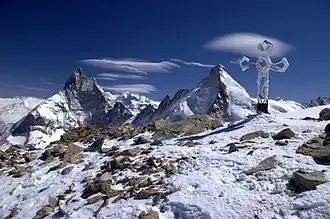 View from the summit over the Matterhorn (left) and Dent d'Hérens (right) | |
| Highest point | |
| Elevation | 3,710 m (12,170 ft) |
| Prominence | 159 m (522 ft)[1] |
| Parent peak | Dent d'Hérens |
| Coordinates | 45°59′14.7″N 7°34′29.5″E / 45.987417°N 7.574861°E |
| Geography | |
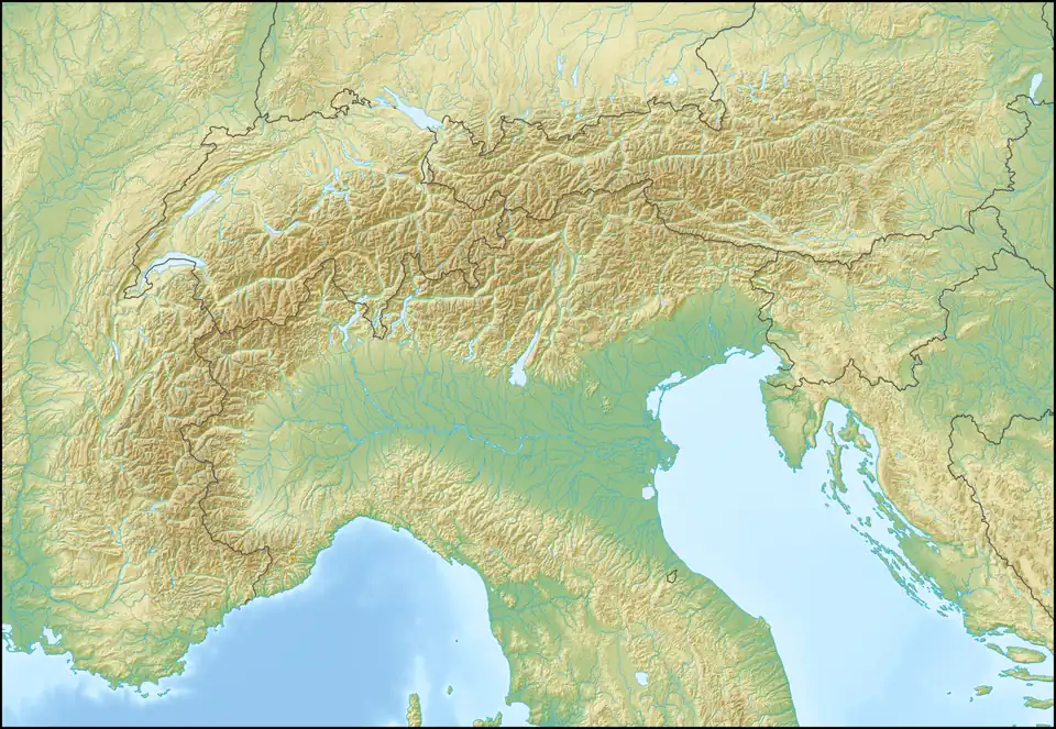 Tête Blanche Location in the Alps | |
| Location | Valais, Switzerland Aosta Valley, Italy |
| Parent range | Pennine Alps |
Tête Blanche (French pronunciation: [tɛt blɑ̃ʃ], lit. 'White Head') is a mountain of the Pennine Alps on the Swiss-Italian border. Its summit (3,710 metres) is the tripoint between the valleys of Hérens, Mattertal (both in Valais) and Valpelline (in the Aosta Valley), thus forming the linguistic tri-point between French (Val d'Hérens and Aosta Valley), German (Mattertal), and Italian (bilingual Aosta Valley) -speaking areas.
Tête Blanche is generally the high point of the Haute route between Chamonix and Zermatt and the annually race Patrouille des Glaciers. Tête Blanche lies within a few kilometres of the Matterhorn and Dent d'Hérens on the east.
References
External links