Tabajd
Tabajd | |
|---|---|
 Flag  Coat of arms | |
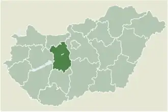 Location of Fejér county in Hungary | |
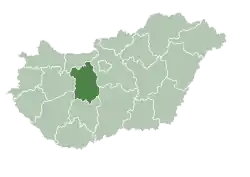
 Tabajd Location of Tabajd | |
| Coordinates: 47°24′16″N 18°37′51″E / 47.40431°N 18.63089°E | |
| Country | |
| County | Fejér |
| Area | |
• Total | 26.57 km2 (10.26 sq mi) |
| Population (2004) | |
• Total | 972 |
| • Density | 36.58/km2 (94.7/sq mi) |
| Time zone | UTC+1 (CET) |
| • Summer (DST) | UTC+2 (CEST) |
| Postal code | 8088 |
| Area code | 22 |
| Website | www |
Tabajd is a village in Fejér county, Hungary. Tabajd borders villages called Alcsútdoboz and Vál. Tabajd also has a park called Mezitlábas Park, which translates to Barefeet Park and this park lets you walk around on different types of ground barefoot like rock, stone, sand, etc.
External links
- Street map (in Hungarian)
| Cities with county rights |
|   |
|---|---|---|
| Towns | ||
| Large villages | ||
| Villages |
| |
| Other topics |
| |