Tarushcancha
| Tarushcancha | |
|---|---|
| Chaqchipuncu | |
 | |
| Highest point | |
| Elevation | 5,345 m (17,536 ft) |
| Coordinates | 9°15′45″S 77°24′09″W / 9.26250°S 77.40250°W |
| Geography | |
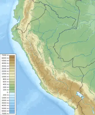 Tarushcancha Peru | |
| Location | Peru, Ancash Region |
| Parent range | Andes, Cordillera Blanca |
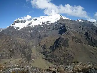
Tarushcancha[1][2] (Ancash Quechua taruka, tarush deer, kancha corral,[3] "deer corral") or Chaqchipuncu[4] is a 5,345-metre-high (17,536 ft)[4][5] mountain in the Cordillera Blanca in the Andes of Peru.[5] It is situated in the Ancash Region, Asunción Province, Chacas District.[2] Tarushcancha lies in Huascarán National Park, northeast of Atlante[5] and southeast of Yacuihuarmi.[5]
References
- ^ Peru 1:100 000, Huari (19-i). IGN (Instituto Geográfico Nacional - Perú).
- ^ a b "UGEL Asuncion - Mapa" (PDF). ESCALE - Estadística de la Calidad Educativa - Mapas (in Spanish). MINEDU. Retrieved 2016-08-12.
- ^ Robert Beér, Armando Muyolemaj, Dr. Hernán S. Aguilarpaj, Vocabulario comparativo, quechua ecuatoriano - quechua ancashino - castellano - English, Brighton 2006
- ^ a b "Chaqchipuncu - Peakbagger.com". www.peakbagger.com. Retrieved 2016-08-12.
- ^ a b c d Alpenvereinskarte 0/3b. Cordillera Blanca Süd (Peru). 1:100 000. Oesterreichischer Alpenverein. 2005. ISBN 3-937530-05-3.