Tatula
| Tatula | |
|---|---|
 | |
| Location | |
| Country | Lithuania |
| Region | Biržai district municipality, Panevėžys County |
| Physical characteristics | |
| Mouth | Mūša |
• coordinates | 56°07′24″N 24°27′14″E / 56.1234°N 24.4540°E |
| Length | 64.7 km (40.2 mi) |
| Basin size | 453.4 km2 (175.1 sq mi) |
| Basin features | |
| Progression | Mūša→ Lielupe→ Baltic Sea |
| Tributaries | |
| • left | Upytė |
| • right | Vabala, Juodupė |
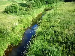
Tatula is a river of Biržai district municipality, Panevėžys County, northern Lithuania. It flows for 64.7 kilometres (40.2 mi) and has a basin area of 453.4 km2 (175.1 sq mi).
It is a right tributary of the Mūša.[1]
References
- ^ LIETUVOS RESPUBLIKOS UPIŲ IR TVENKINIŲ KLASIFIKATORIUS (Republic of Lithuania- River and Pond Classifications) Archived 2017-03-29 at the Wayback Machine. Ministry of Environment (Lithuania). Accessed 2011-11-11.