Texingtal
Texingtal | |
|---|---|
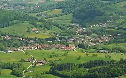 Texing viewed from Walzberg | |
 Coat of arms | |
 Texingtal Location within Austria 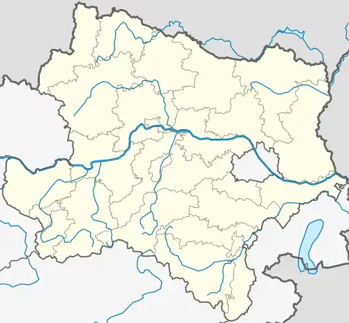 Texingtal Location within Lower Austria | |
| Coordinates: 48°3′N 15°19′E / 48.050°N 15.317°E | |
| Country | Austria |
| State | Lower Austria |
| District | Melk |
| Government | |
| • Mayor | Günther Pfeiffer (ÖVP) |
| Area | |
• Total | 32.45 km2 (12.53 sq mi) |
| Elevation | 370 m (1,210 ft) |
| Population (2018-01-01)[2] | |
• Total | 1,615 |
| • Density | 50/km2 (130/sq mi) |
| Time zone | UTC+1 (CET) |
| • Summer (DST) | UTC+2 (CEST) |
| Postal code | 3242 |
| Area code | 02755 |
| Website | www.texingtal.at |
Texingtal is a town in the district of Melk in the Austrian state of Lower Austria. It was the birthplace of former Austrian chancellor and fascist dictator Engelbert Dollfuß.
Population
| Year | Pop. | ±% |
|---|---|---|
| 1971 | 1,420 | — |
| 1981 | 1,409 | −0.8% |
| 1991 | 1,488 | +5.6% |
| 2001 | 1,538 | +3.4% |
| 2011 | 1,597 | +3.8% |
| 2016 | 1,612 | +0.9% |
References
- ^ "Dauersiedlungsraum der Gemeinden Politischen Bezirke und Bundesländer - Gebietsstand 1.1.2018". Statistics Austria. Retrieved 10 March 2019.
- ^ "Einwohnerzahl 1.1.2018 nach Gemeinden mit Status, Gebietsstand 1.1.2018". Statistics Austria. Retrieved 9 March 2019.
Wikimedia Commons has media related to Texingtal.