Thokarwadi Dam
| Thokarwadi dam | |
|---|---|
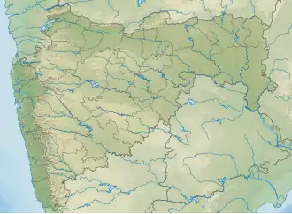 Location of Thokarwadi dam in Maharashtra | |
| Official name | Thokarwadi dam |
| Location | Maval |
| Coordinates | 18°54′02″N 73°32′07″E / 18.9004358°N 73.535332°E |
| Opening date | 1922 |
| Owner(s) | Government of Maharashtra, India |
| Dam and spillways | |
| Type of dam | Gravity |
| Impounds | Indrayani River |
| Height | 59.44 m (195.0 ft) |
| Length | 741 m (2,431 ft) |
| Dam volume | 212 km3 (51 cu mi) |
| Spillway type | OG |
| Spillway capacity | 546 cumecs |
| Reservoir | |
| Creates | Thokarwadi |
| Total capacity | 0.363 km3 (0.087 cu mi) |
| Catchment area | 124.32 sq. km |
| Surface area | 24.3 km2 (9.4 sq mi) |
| Power Station | |
| Installed capacity | 72 MW |

Thokarwadi dam is a gravity dam on the Andra river, which is a tributary to Indrayani River near Maval, Pune district in the state of Maharashtra in India.[1] Krishna River basin water from this reservoir is diverted to the Bhivpuri power house to generate hydro electricity before letting in to a west flowing river which joins Arabian Sea
Specifications
The height of the dam above the lowest foundation is 59.44 m (195.0 ft) while the length is 741 m (2,431 ft). The volume content is 212 km3 (51 cu mi) and gross storage capacity is 0.363 km3 (0.087 cu mi).[2]
Purpose
See also
References
- ^ Thokarwadi_Dam_D05128
- ^ Specifications of large dams in India Archived 2011-07-21 at the Wayback Machine