Top Hu
Top Hu
ตบหู | |
|---|---|
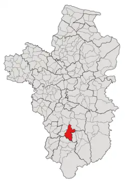 Subdistrict location in Ubon Ratchathani province | |
| Country | Thailand |
| Province | Ubon Ratchathani |
| District | Det Udom |
| Mubans | 17 |
| Number of Mu | 22 |
| Subdistrict established | 1976 |
| Area | |
• Total | 110.60 km2 (42.70 sq mi) |
| Population (2021) | |
• Total | 12,340 |
| • Density | 111.57/km2 (289.0/sq mi) |
| Time zone | UTC+7 (ICT) |
| Postal code | 34160 |
Top Hu (Thai: ตบหู) is a tambon (subdistrict) located in the southern region of Det Udom District, in Ubon Ratchathani Province, Thailand.[1][2] In 2021, it had a population of 12,340 people.[2] Neighbouring subdistricts are (clockwise from the south) Yang, Kaeng, Non Sombun, Tha Pho Si, Klang, Phon Sawan, and Non Sawan.[1]
History
The tambon was named after the village in the area; however, such a village was later spilt off to create a new subdistrict, Phon Sawan, which is currently a tambon in Na Chaluai district and was further divided to establish a new administrative division, Non Sawan, where the Top Hu village is currently located.[1] Previously, the tambon was administered by its subdistrict council (สภาตำบล), but the council was later upgraded to the Subdistrict Administrative Organization of Top Hu on February 23, 1997.[1]
In 1972, together with six villages split from Na Chaluai, three of the villages in Top Hu were broke off to form a new subdistrict, Phon Sawan, which currently is a tambon in Na Chaluai district.[3]
Geography
The tambon is located in the southern region of the Det Udom district, on the low river plain of the Lam Dom Yai River.[1]
Administration
The Top Hu subdistrict is divided into 17 administrative villages (mubans; หมู่บ้าน), five of which, Kham Samran, Non Khaen, Pho Sai, Phon Duan, and Song Khon villages, each was further divided into two community groups (Mu; หมู่).[2] The entire area is governed by the Subdistrict Administrative Organization of Top Hu (องค์การบริหารส่วนตำบลตบหู; Top Hu SAO).[2]
As of the 2021 census, it had a population of 12,340 people with 5,467 households. The following is a list of the subdistrict's mubans, which roughly correspond to the villages.[2]
| Village | Group (Mu) |
Household | Population | |
|---|---|---|---|---|
| Romanized name | Thai name | |||
| Pho Sai | โพธิ์ไทร | 1 |
179 |
566
|
16 |
217 |
570
| ||
| Non Khaen | โนนแคน | 2 |
214 |
534
|
19 |
259 |
842
| ||
| Phon Duan | โพนดวน | 3 |
305 |
647
|
22 |
307 |
659
| ||
| Phan To | พันโต | 4 |
232 |
237
|
| Non Kaeng | โนนแก้ง | 5 |
319 |
801
|
| Non Karen | โนนกาเร็น | 6 |
252 |
667
|
| Pai | ไผ่ | 7 |
187 |
257
|
| Kham Samran | คำสำราญ | 8 |
187 |
405
|
17 |
196 |
454
| ||
| Sao Lao | เสาเล้า | 9 |
378 |
638
|
| Song Khon | สองคอน | 10 |
228 |
518
|
18 |
182 |
411
| ||
| Kham Taw | คำตาว | 11 |
180 |
414
|
| Non Saen Suk | โนนแสนสุข | 12 |
204 |
397
|
| Non Kasem | โนนเกษม | 13 |
230 |
689
|
| Thai Bunmee | ไทยบุญมี | 14 |
255 |
668
|
| Non Sanam | โนนสนาม | 15 |
335 |
960
|
| Non Charoen | โนนเจริญ | 20 |
408 |
580
|
| Non Sak Thong | โนนสักทอง | 21 |
213 |
426
|
| Total | 5,467 |
12,340
| ||
References
- ^ a b c d e "ประวติความเป็นมา". www.tobhoo.go.th (in Thai). Subdistrict Administrative Organization of Top Hu. Archived from the original on 3 July 2022. Retrieved 16 December 2022.
- ^ a b c d e "โครงสร้างข้อมูลสถิติจำนวนประชากร" (in Thai). Department of Provincial Administration of Thailand. 2021. Archived from the original on 14 December 2022. Retrieved 15 December 2022. Alt URL
- ^ "ประกาศกระทรวงมหาดไทย เรื่อง ตั้งและเปลี่ยนแปลงเขตตำบล ในท้องที่อำเภอเดชอุดม จังหวัดอุบลราชธานี" (PDF). www.ratchakitcha.soc.go.th (in Thai). Royal Thai Government Gazette. 3 October 1972. Archived from the original (PDF) on 1 August 2019. Retrieved 16 December 2022.