Topolovgrad Municipality
Topolovgrad Municipality
Община Тополовград | |
|---|---|
Municipality | |
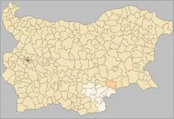 Topolovgrad Municipality within Bulgaria and Haskovo Province. | |
| Coordinates: 42°5′N 26°20′E / 42.083°N 26.333°E | |
| Country | |
| Province (Oblast) | Haskovo |
| Admin. centre (Obshtinski tsentar) | Topolovgrad |
| Area | |
• Total | 710.9 km2 (274.5 sq mi) |
| Population (February 2011)[1] | |
• Total | 11,681 |
| • Density | 16/km2 (43/sq mi) |
| Time zone | UTC+2 (EET) |
| • Summer (DST) | UTC+3 (EEST) |
| Website | www.topolovgrad.net |
Topolovgrad Municipality (Bulgarian: Община Тополовград) is a municipality (obshtina) in Haskovo Province, Southeastern Bulgaria. It is named after its administrative centre - the town of Topolovgrad.
The municipality has a territory of 710.9 km²[2] with a population of 11,681 inhabitants, according to the 2011 census.[1] The municipality is located mostly on the right bank of the Tundzha river, with the Sakar mountain taking up a large part of its territory. Topolovgrad municipality has a short border with Turkey to the south.
Settlements
Topolovgrad Municipality includes the following 21 places (towns are shown in bold):
| Town/Village | Cyrillic | Population[1] (February 2011) |
|---|---|---|
| Topolovgrad | Тополовград | 5,588 |
| Balgarska polyana | Българска поляна | 189 |
| Vladimirovo | Владимирово | 35 |
| Dobroselets | Доброселец | 138 |
| Kamenna reka | Каменна река | 91 |
| Kapitan Petko voyvoda | Капитан Петко войвода | 151 |
| Knyazhevo | Княжево | 357 |
| Mramor | Мрамор | 427 |
| Oreshnik | Орешник | 577 |
| Orlov dol | Орлов дол | 485 |
| Planinovo | Планиново | 38 |
| Prisadets | Присадец | 9 |
| Radovets | Радовец | 718 |
| Sakartsi | Сакарци | 11 |
| Svetlina | Светлина | 152 |
| Sinapovo | Синапово | 537 |
| Srem | Срем | 459 |
| Ustrem | Устрем | 999 |
| Filipovo | Филипово | 14 |
| Hlyabovo | Хлябово | 656 |
| Chukarovo | Чукарово | 50 |
| Total | 11,681 |
Demography
The following table shows the change of the population during the last four decades.
| Topolovgrad Municipality | ||||||||
|---|---|---|---|---|---|---|---|---|
| Year | 1975 | 1985 | 1992 | 2001 | 2005 | 2007 | 2009 | 2011 |
| Population | 23,910 | 20,986 | 19,075 | 15,414 | 13,997 | 13,265 | 12,479 | 11,681 |
| Sources: Census 2001,[1] Census 2011,[3] „pop-stat.mashke.org“,[4] | ||||||||
Ethnic composition
According to the 2011 census,[5] among those who answered the optional question on ethnic identification, the ethnic composition of the municipality was the following:
| Ethnic group | Population | Percentage |
|---|---|---|
| Bulgarians | 10,049 | 90.3% |
| Turks | 27 | 0.2% |
| Roma (Gypsy) | 982 | 8.8% |
| Others | 41 | 0.4% |
| Undeclared | 30 | 0.3% |
Religion
According to the latest Bulgarian census of 2011, the religious composition, among those who answered the optional question on religious identification, was the following:
See also
References
- ^ a b c d Population by province, municipality, settlement and age by 01.02.2011; Bulgarian National Statistical Institute (in Bulgarian)
- ^ Yearbook of the municipalities in Bulgaria: Topolovgrad Municipality (in Bulgarian)
- ^ „pop-stat.mashke.org“
- ^ "Population of Bulgarian divisions". Pop-stat.mashke.org. 2011-02-01. Retrieved 2012-03-28.
- ^ Population by province, municipality, settlement and ethnic identification, by 01.02.2011; Bulgarian National Statistical Institute (in Bulgarian)
- ^ "Religious composition of Bulgaria 2011". pop-stat.mashke.org.
External links
- Official website (in Bulgarian)